

Hydrologic Modelling
Modelling of surface water processes and fluxes is conducted on a variety of scales in the lab. Students make use of remote sensing derived and insitu measured properties including meterological, land use and cover, geology, topography, river flow volumes, sediment concentrations and nutrient concentrations, tom model how different hydrologic systems work, and what the various water fluxes in teh system are.
Students have modelled processes from the scale of a municipal landfill to portions of the Nile River.
With these models, we are able to ask important scientific questions, and examine the impacts of a variety of land cover, land use and climate changes on a hydrologic system.
Past projects include the modelling of different types of evapotranspirative covers on a landfill to determine the appropriateness of different types of evapotranspirative landfill cover.
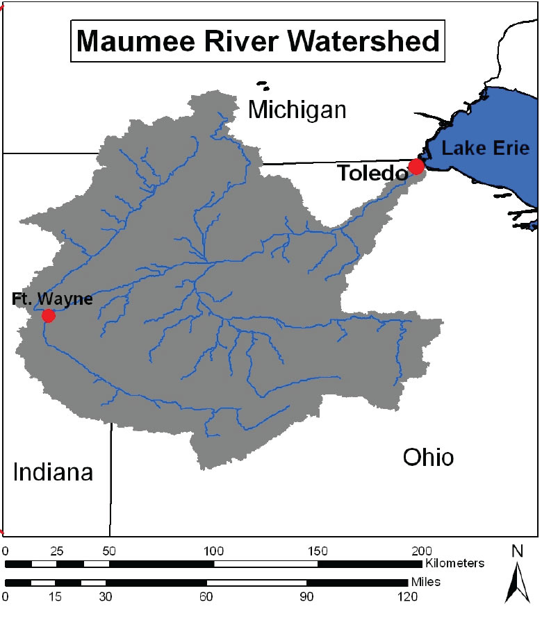
Ongoing projects include modelling the effects of land use change and future climate variability on runoff and sediment delivery into the western basin of Lake Erie. Sediment and nutrient delivery and timing are important factors in Algal blooms in the western basin, and an accurate model will help understand the drivers for timing and delivery of nurtient loads.
Recent Presentations:
Becker, R.H., Zmijewski, K. A.*, 2012, Climate and Cultural Impacts on Water Flow in The Maumee River, OH, GSA Abstracts with Programs, GSA Abstracts with Programs Vol. 44, No. 7
Becker, R.H., Zmijewski, K. A.*, 2012,Modeling Climate Change Effects on Maumee River Discharge, GSA Abstracts with Programs, 46th Annual Meeting, North-Central Section of the Geological Society of America, Dayton, Ohio, USA, 23–24 April 2012
On a broader resource scale, climate variability will affect water resources on a regional basis as well. In areas where there is potential for significant water shortages (i.e. in the middle east), climate models can provide insight to future water availability. in addition to examining climate dependance on past fluctuations in Nile River discharge, we are beginning to model the upper Blue Nile in order to study the potential future impact of climate variability of water resources available to Nile Basin countries.
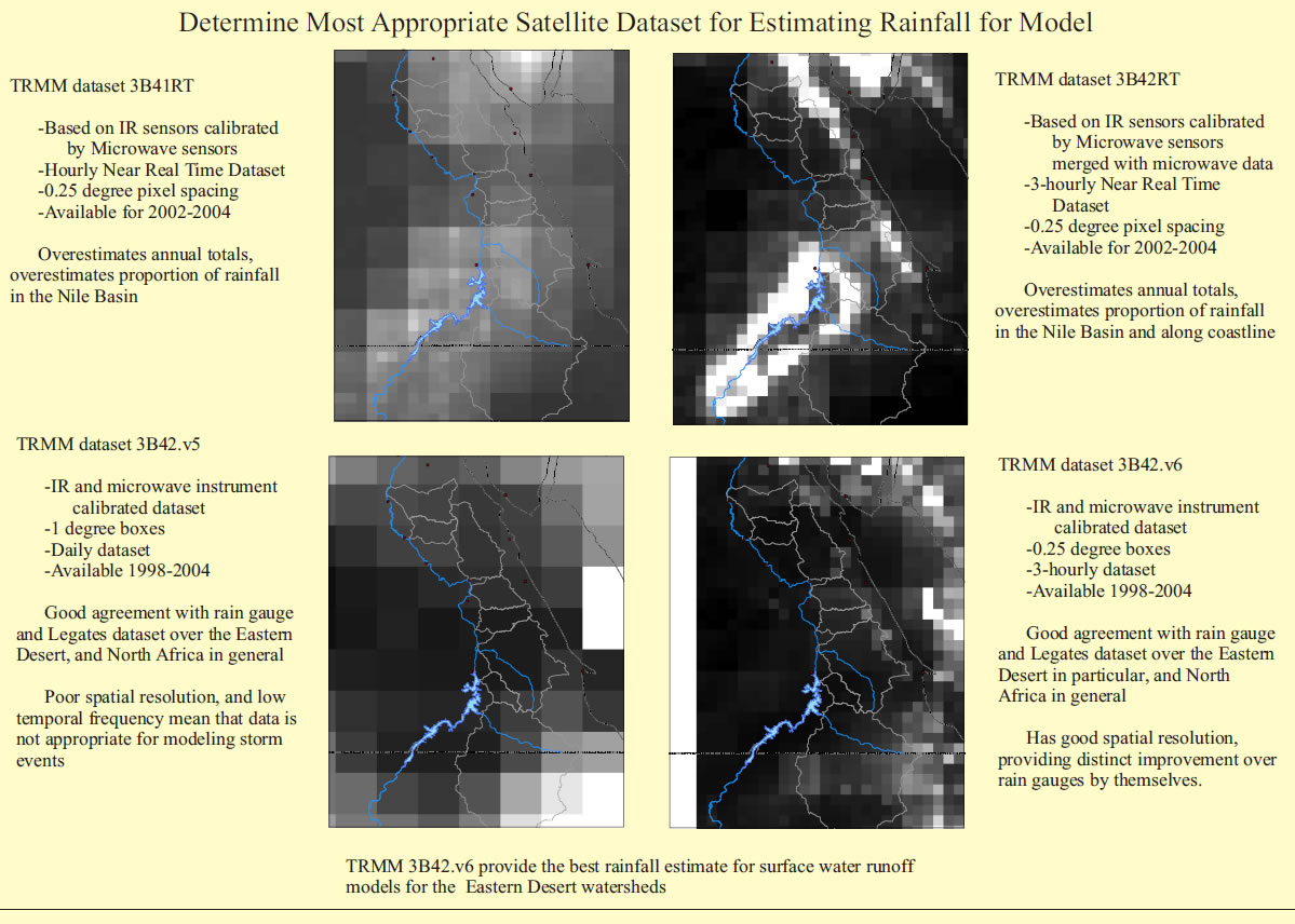
Many of these projects make use of remotely sensed data, such as satellite rainfall or sateliite ET estimates.