
Who we are:
ESRL, or the Environmental Remote Sensing Lab is a research group located in the Bowman-Oddy building at the University of Toledo in Toledo, Ohio. ESRL is headed by Dr. Richard Becker who is an Assistant Professor of Geology at UT.
What we are about:
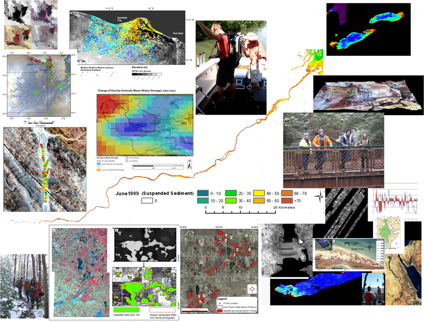
At the Environmental Remote Sensing Lab, we undertake research which incorporates an interdisciplinary research approach (remote sensing, geochemistry, hydrologic modeling, and field techniques) to investigate a wide range of geological and environmental problems including the assessment of responses of natural systems to climatic and human activities.
Of particular interest are remote sensing hydrology and hydrologic modeling in response to climate change, surface change from radar interferometry, and aquatic and terrestrial vegetation change mapping.
Types of research we do:
Great Lakes:
- Identify and map potential harmful algal blooms from satellite imagery
- Examine the impacts of land use change on blooms and other systems in the Laurentian Great Lakes
Egypt, the Nile and the Aswan High Dam:
- Study the impact on the Nubian aquifer in Northeastern Africa and Nile watershed of the construction of the Aswan High Dam
- Monitor the changes in recharge rates using GRACE and subsidence rates in the Nile Delta using radar interferometry
- Investigate the effects climate change on this system
We utilize a wide variety of remote sensing and GIS techniques to investigate water resources and the impacts that human use may have on them.
Follow the links to the left for additional information on other research projects, courses offered, publications, and more.