
The "mise-à-la-masse" method (see Parasnis, 1973, page 195) was used in an attempt to map a sediment-filled fracture east of Sheriden Cave. A soil auger inserted over 2 meters into a borehole was used as one electrode. The second current electrode was planted near the large sign about 100 meters to the northwest, and the reference potential electrode was planted a similar distance to the south. Both locations (Figure 1) were surveyed in with the GPS.
"Mise-à-la-masse" means "excitation of the body," meaning a body of ore. Electrical current is sent directly into a conductive rock formation, with the second current electrode planted far away ("infinity") to complete the circuit. Electrical potential (voltage) is measured at various locations around the excitation electrode. The reference potential electrode is also set at "infinity" – far enough away from the area under study (and from the distant current electrode) to remain unaffected by test currents. In this case, porous moist sediment filling a fracture in otherwise solid dolomite conducts electricity better than the low-porosity dolomite. Voltage measurements map distortions in the electrical field caused by currents flowing more easily through the sediments than through dolomite.
Electrical current was sent into the earth from a Soiltest R-60 transmitter, and the R-60 potentiometer was used to measure the potential difference between the reference electrode and a roving porous pot electrode. Current was measured with an electronic volt-ohm meter (VOM) and current and potential readings were recorded in a field book. Rover locations were measured by placing a single retroprism next to the electrode and using the Sokkia Set3BII Electronic Total Station. Locations were read in terms of meters north, east and vertical from this instrument. The instrument location with respect to the surface site datum had been previously determined. The maps produced are thus tied to the surface site datum.
Figure 2 shows electrical voltages, normalized for variations in current, in the vicinity of the borehole (black dot just southwest of the intersection of grid lines 10 East and -32 North). "X" symbols indicate locations where measurements were made. Figure 2 is dominated by the effects of geometry, the nearly concentric equipotential contours of an electrical monopole. The electrical field expected from this geometry is
(1)
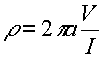
where r is the electrical resistivity of the ground, a is the distance between the current electrode and the potential measurement point, V is the measured voltage, and I is the electrical current. Figure 3 was plotted based on voltages adjusted for map distance from the borehole. Concentric circles suggest that the distance factor has not been entirely removed. However, Figure 3 shows more clearly an elongation of equipotential contours eastward from the current electrode, suggesting that rocks in this direction are better conductors than are rocks in other directions.
Figure 4 uses total distance a from the point where electrical current flows into rocks
(2) ![]()
where (N, E and Z) represent the locations of the current electrode (subscripts 0) and roving potential electrode positions (subscripts P). Figure 4 shows variations in the apparent resistivity of the ground based on the equation
(3) 
(Grant and West, 1965, equation 14-5).
Interpretation: In Figure 4, it appears that a resistivity low extends east about 4 meters and southeast about 3.5 meters from the borehole. This resistivity low could represent moist, porous sediment filling a fracture in otherwise high-resistivity Lockport Dolomite. I must note here that even if conductive sediments fill a fracture extending into the pit (Sheridan Cave), electrical current will not follow it for a great distance because excavation has truncated the electrical conductor. It would thus be difficult to map a truncated structure using the geometry employed here. High apparent resistivities to the northwest of the borehole suggest solid rock in that direction.
Ground truth: Excavation of 5 units, each 1 meter square, revealed shallow bedrock north and south of the sediment-filled fracture. Further excavation may test the interpretation that this fracture extends 4 meters to the east and southeast.
REFERENCES CITED
Grant, F.S. and G.F. Grant, Interpretation Theory in Applied Geophysics; McGraw-Hill, Toronto, 1965, 584 pp.
Parasnis, D.S., Mining Geophysics (Second Revised Edition); Elsevier, Amsterdam, 1973, 395 pp.