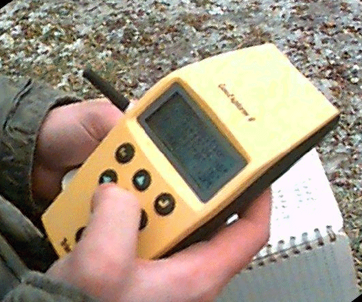
Trimple GeoExplorer II uses military navigation satellites to calculate this receiver's position. Approximately 30 seconds are needed to collect readings once a fix on sufficient satellites is obtained. These readings, stored in memory and downloaded in the laboratory computer, are then corrected for small systematic errors by comparison with base station readings downloaded from the World Wide Web. Relative accuracy of less than 1 meter horizontal position is not uncommon - vertical accuracy seems to be on the order of 3 to 5 meters, based on field trials to date.
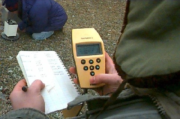
One student uses Trimble GeoExplorer II to check position of gravity base station while another student occupies the gravity base at the end of a day in the field. We obtained these instruments, thanks to a grant from The National Science Foundation, for the purpose of instructing students enrolled in The University of Toledo's Environmental Sciences/Environmental Studies programs in their applications to environmental field work.