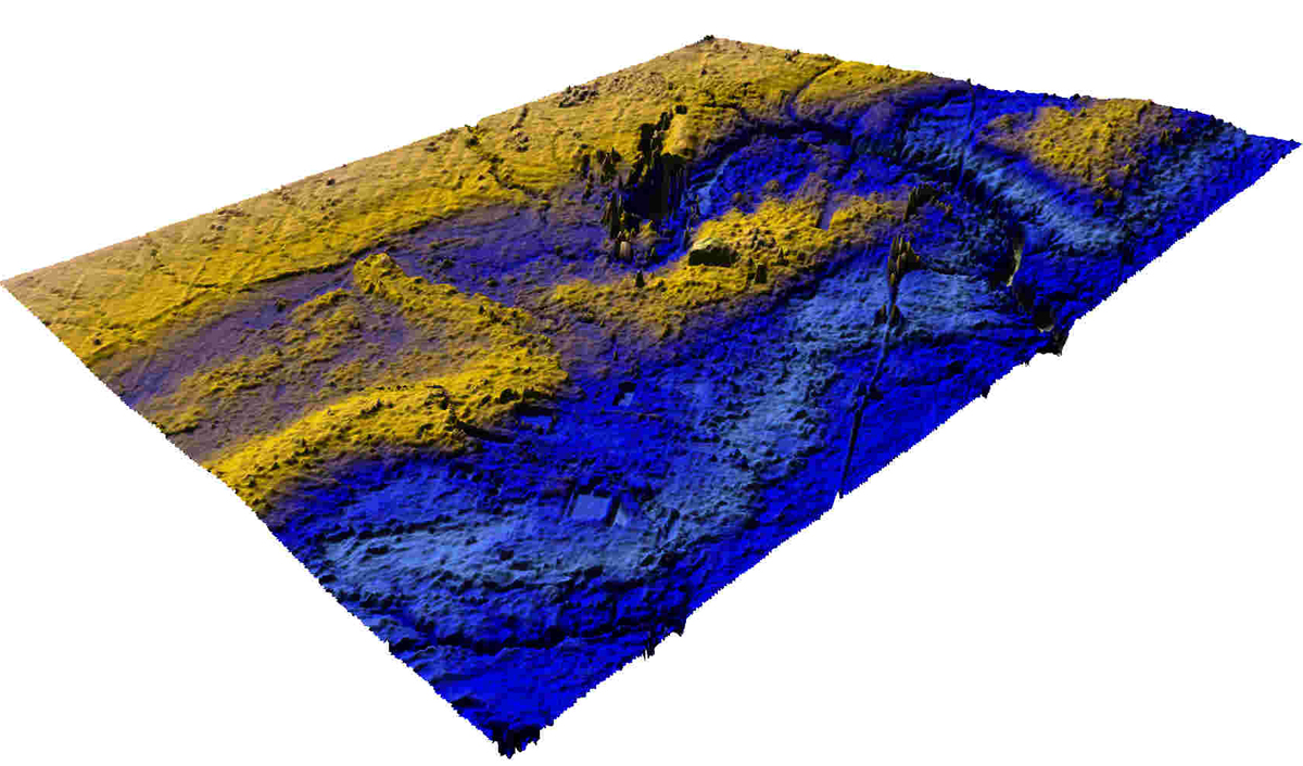
 Figure
7A: Surface map (view from south) of
barrier island, spit and mainland. Deeply eroded channel (10-Mile Creek – see
Figure 2) is due to millennia of post-glacial downcutting.
Figure
7A: Surface map (view from south) of
barrier island, spit and mainland. Deeply eroded channel (10-Mile Creek – see
Figure 2) is due to millennia of post-glacial downcutting.Perspective Views of Barrier Island
Figure
7A: Surface map (view from south) of
barrier island, spit and mainland. Deeply eroded channel (10-Mile Creek – see
Figure 2) is due to millennia of post-glacial downcutting.
 Figure
7B: Surface map showing deltas that developed when lake level dropped a few
meters and barrier island was breached. Delta to the south remains intact while
the northern delta was eroded by 10-Mile Creek.
Figure
7B: Surface map showing deltas that developed when lake level dropped a few
meters and barrier island was breached. Delta to the south remains intact while
the northern delta was eroded by 10-Mile Creek.