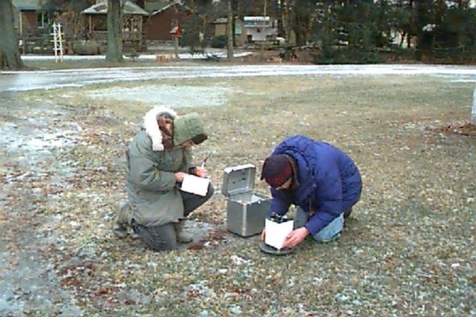
 Student researchers occupy field base station near
Liberty Crater.
Student researchers occupy field base station near
Liberty Crater.Geophysical Instruments
by Dr. Don Stierman - updated
01/22/2004
Field instruments are the foundation of geophysical exploration. The Department of Earth, Ecological & Environmental Sciences is well equipped for geophysical measurements in support of environmental and engineering investigations. Please click on thumbnails for full-screen display of photographs.
Gravity meter: LaCoste & Romberg model "G" (#1109), purchased in 1997. This instrument is useful in mapping (among other things) variations in top of bedrock under till.
Student researchers occupy field base station near
Liberty Crater.
Proton precession magnetometer (Geometrics G-856, gradiometer configuration). Although proton precession technology has been superceded by the sodium vapor magnetometer, this old reliable workhorse remains adequate for our needs, from archaeological site surveys to prospecting for underground storage tanks. Magnetic susceptibility of individual rocks, rock cores or soil samples can be measured using either our KT-9 Kappameter or our Bison model 3101A magnetic susceptibility meter.
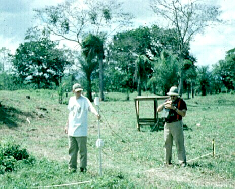 Graduate student (white shirt) holds magnetic gradiometer (2 sensors at
different heights), assisting Dr. Stierman in mapping anomalies at the
Talgua Village
(Honduras) archaeological site, June of 1996.
Graduate student (white shirt) holds magnetic gradiometer (2 sensors at
different heights), assisting Dr. Stierman in mapping anomalies at the
Talgua Village
(Honduras) archaeological site, June of 1996.
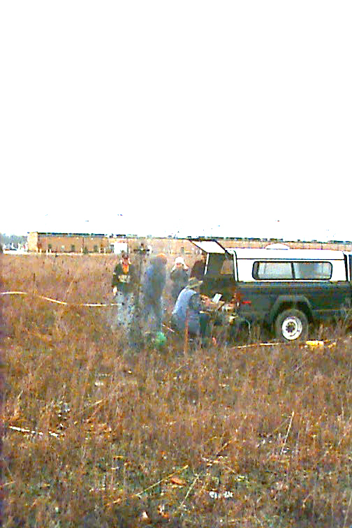
Engineering seismograph: Geometrics GEODE (24 channels) with Panasonic "Toughbook" laptop, purchased 2003. 2 sets of cables (35-foot and 100-foot take-outs) and 2 sets of geophones (4.5 Hz vertical, 100 Hz horizontal/vertical). Seismic energy is produced by sledge hammer or "Betsy" seisgun (300-grain or 500-grain 8-gauge industrial blanks detonated about 1 meter under the earth's surface).
 Seismograph operator (seated) is about to be showered with dirt blown out of
the seismic shot-hole as Betsy(TM) experiences lift-off.
The remaining seismic shots detonated by this crew were more deeply buried.
Seismograph operator (seated) is about to be showered with dirt blown out of
the seismic shot-hole as Betsy(TM) experiences lift-off.
The remaining seismic shots detonated by this crew were more deeply buried.
Electrical resistivity and induced polarization system: AGI SuperString R1 IP, purchased 2003.
 Students make certain that electrode planters are not part of the circuit
before transmitting a 200-volt, 80 milliamp signal into the earth near the
King Road
landfill.
Students make certain that electrode planters are not part of the circuit
before transmitting a 200-volt, 80 milliamp signal into the earth near the
King Road
landfill.
Geonics EM34-3XL earth conductivity meter with data logger. Although purchased over 10 years ago, this device has been used to map variations in till thickness and locate water-filled caves concealed under the till plains along the southwest shores of Lake Erie.
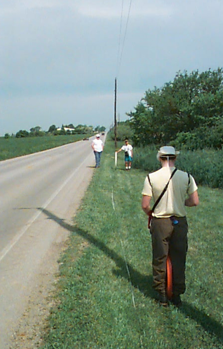 Students use EM34 (white transmitting coil 20 meters down the road from the
orange receiver coil held between the knees of man facing away from camera)
while prospecting for sediment-filled voids near
Sheridan Cave, Ohio.
Students use EM34 (white transmitting coil 20 meters down the road from the
orange receiver coil held between the knees of man facing away from camera)
while prospecting for sediment-filled voids near
Sheridan Cave, Ohio.
Ground-penetrating radar (purchased 2003).
Sensors & Software PulseEKKO 100A Geological System; 50 MHz, 100 MHz, and 200
MHz antennas for a range of vertical resolution and penetration depths
appropriate for different geologic settings and study objectives. 1000 V
transmitter for deeper penetration, wheel odometer and high-speed acquisition
for continuous surveying, EKKO_View Deluxe and EKKO_3D processing and
visualization software.
http://www.sensoft.on.ca/products/pulseekko/ekko_100.html
http://www.sensoft.on.ca/products/pulseekko/ekko_100_geological.html
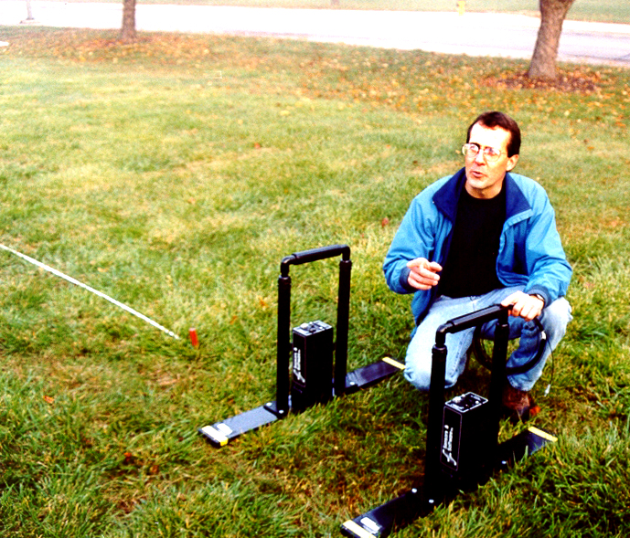 Dr.
David Krantz explains procedures for operating this GPR system. Dr.
Krantz supervises use of the GPR and marine seismic system.
Dr.
David Krantz explains procedures for operating this GPR system. Dr.
Krantz supervises use of the GPR and marine seismic system.
: EdgeTech shallow-tow chirp seismic X-STAR
topside data acquisition system; SB-512i towfish, swept-frequency from 500 Hz
to 12 kHz; 75 m cable. Designed primarily for use in shallow marine,
estuarine or lake environments to approximately 300 m. Excellent
vertical resolution (8 to 20 cm) of bedding with penetration of 20 to
100 m, depending upon bottom sediments.
http://www.edgetech.com/subbottomlevel3s2000XStar.html