Kitty Todd Ground-penetrating Radar
 Figure
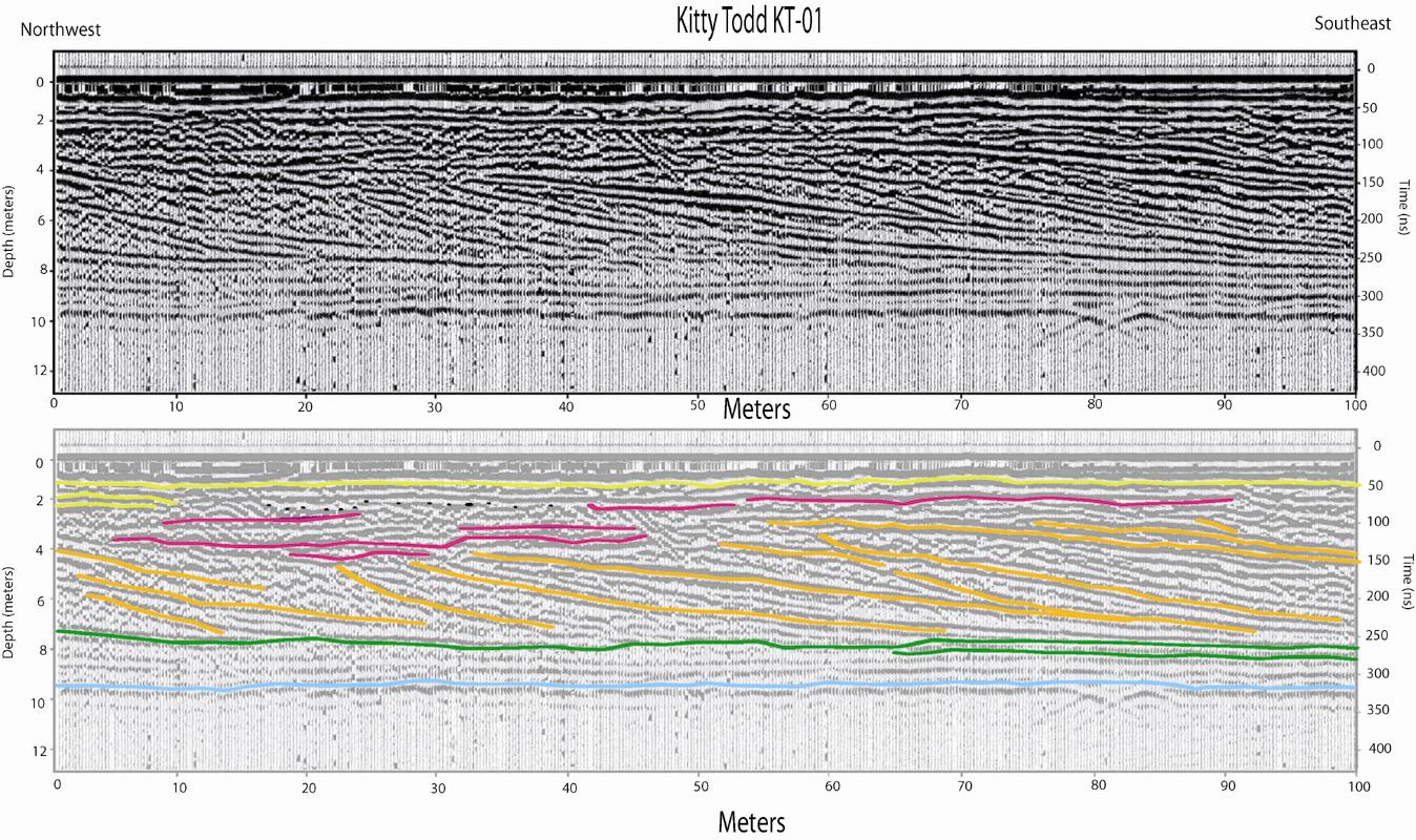
9: GPR
profile KT01 from Kitty Todd Nature Reserve (Figure 4). Reflections dipping to
the southeast (gold) are interpreted as beach faces. Reflections on the
northwest half of this profile are truncated by horizontal reflections (red) 4
meters under the surface (surface elevation = 207 meters), while dipping
reflections to the southeast are truncated 2 meters below the surface,
suggesting a rising lake level.
Figure
9: GPR
profile KT01 from Kitty Todd Nature Reserve (Figure 4). Reflections dipping to
the southeast (gold) are interpreted as beach faces. Reflections on the
northwest half of this profile are truncated by horizontal reflections (red) 4
meters under the surface (surface elevation = 207 meters), while dipping
reflections to the southeast are truncated 2 meters below the surface,
suggesting a rising lake level.
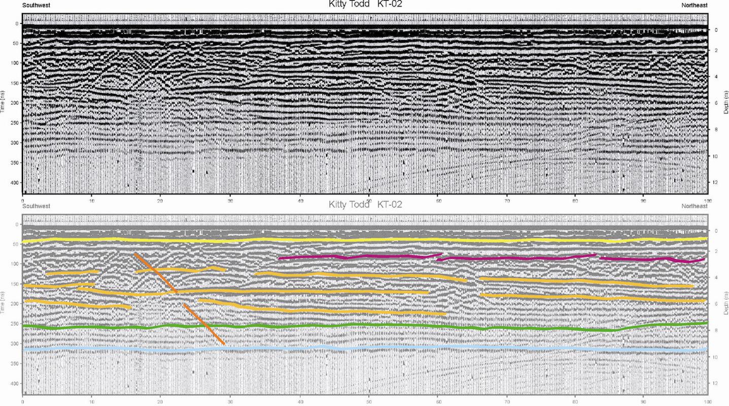
Figure 10: GPR
profile KT02 (Figure 4), perpendicular to KT01. Reflections are nearly
horizontal, indicating that this profile is nearly parallel to the strike of the
buried beach faces. Beaches were deposited on horizontal sediments (sand?
Green line) that rest on nearly horizontal bedrock (light blue). Steeply
dipping orange line (and all lines of similar dip, either to the right or left)
is a reflection from a surface feature such as a tree.
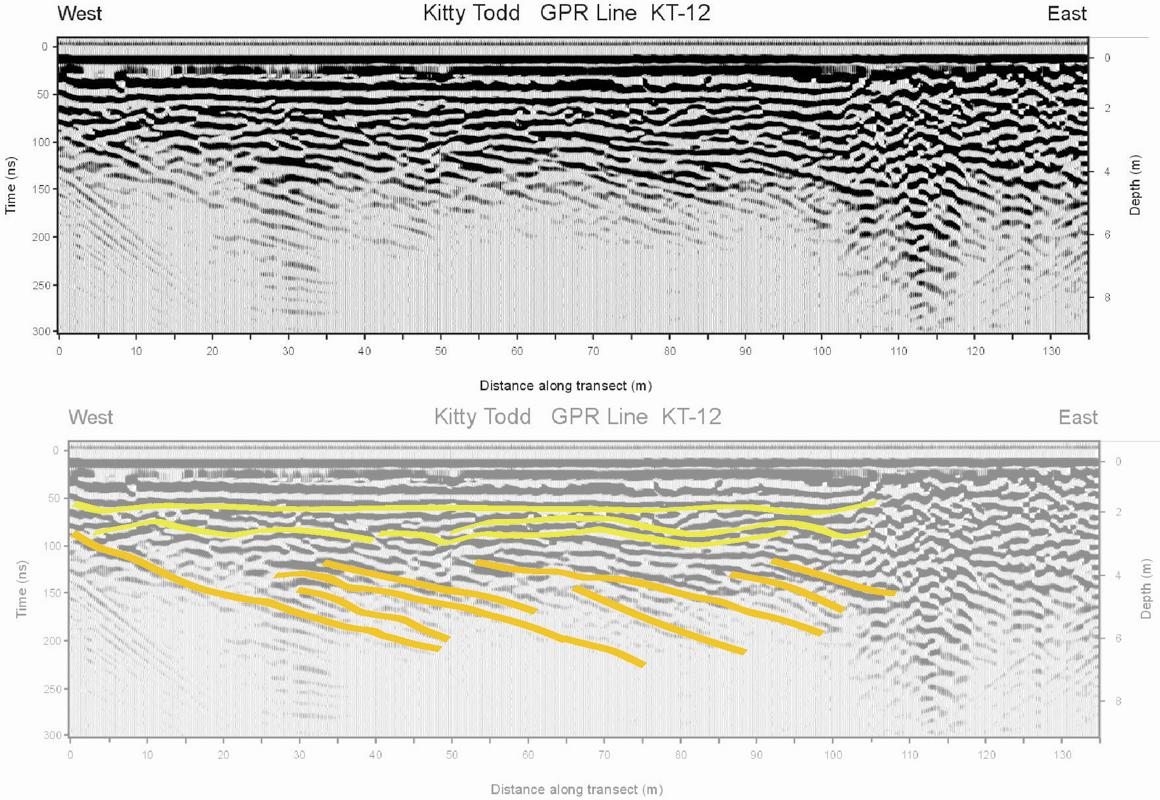
Figure 11: GPR
profile KT11 (Figure 4). As in Figure 10, reflections appear horizontal because
profile bearing is about parallel to strike.
Figure 12:
KT12 (perpendicular to KT11) reflections marked in gold show east-dipping
beach faces and growth of the barrier eastward.
Return to Opening Page
Return to location maps

 Figure
9: GPR
profile KT01 from Kitty Todd Nature Reserve (Figure 4). Reflections dipping to
the southeast (gold) are interpreted as beach faces. Reflections on the
northwest half of this profile are truncated by horizontal reflections (red) 4
meters under the surface (surface elevation = 207 meters), while dipping
reflections to the southeast are truncated 2 meters below the surface,
suggesting a rising lake level.
Figure
9: GPR
profile KT01 from Kitty Todd Nature Reserve (Figure 4). Reflections dipping to
the southeast (gold) are interpreted as beach faces. Reflections on the
northwest half of this profile are truncated by horizontal reflections (red) 4
meters under the surface (surface elevation = 207 meters), while dipping
reflections to the southeast are truncated 2 meters below the surface,
suggesting a rising lake level.