Prepared and posted by: Dr. Don Stierman
Geophysical method: Dipole-dipole resistivity
Survey conducted: April, 2004
Participants: Dr. Don Stierman, Amy Wilt, Tricia Gallant
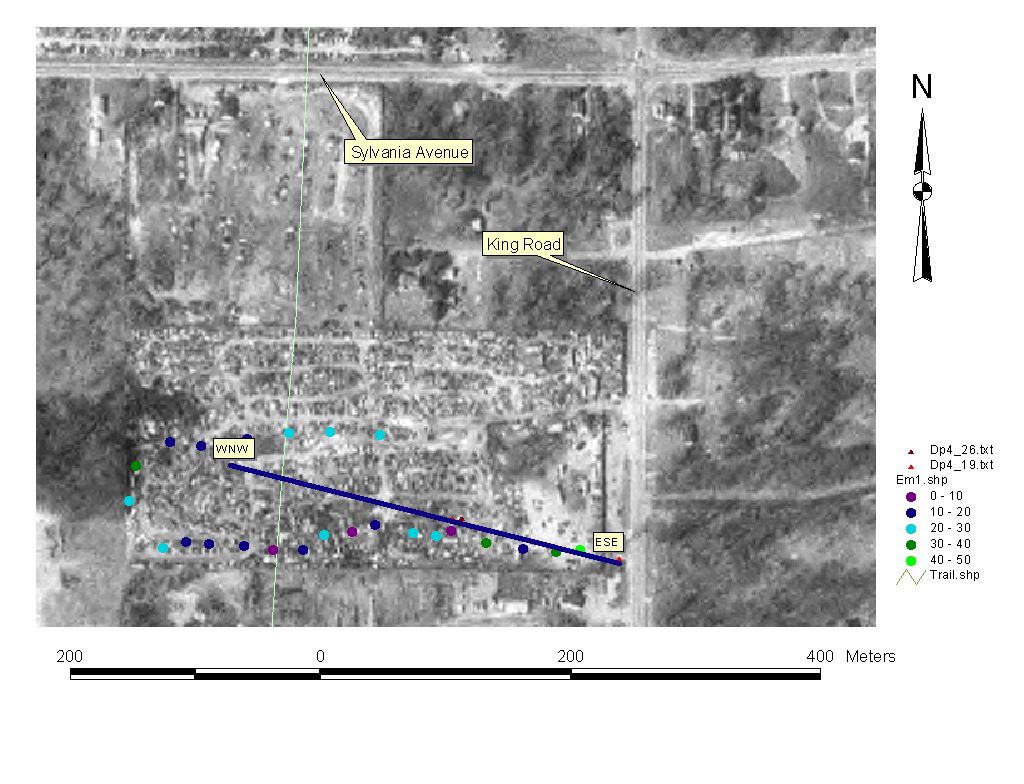
Map shows location of dipole-dipole resistivity survey on now vacant land, former automobile parts recycling business active when this aerial photograph was taken (about 1994). Heavy line shows location of modified pseudosection shown below.
Colored circles show results of EM34 measurements made here in February of 2004.
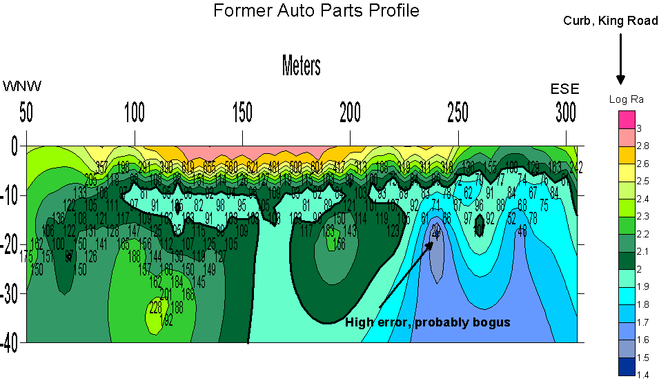
Depth scale is also meters (significant vertical exaggeration). We will run this profile again in order to test our ability to reproduce values, to obtain better deep coverage on the eastern half of the profile, and extend this profile to the west.
Interpretation (tentative): high resistivities indicate clean sand (GPR should work well here) and/or shallow bedrock. I suspect thick sand toward the ESE, shallowing of top of bedrock to the WNW. The bedrock/sand contact may be quite irregular. None of these measurements suggest significant subsurface clay.
April 29, 2004