EM34-3XL Apparent Conductivities
King Road Reconnaissance 9/13/2003
Dr. Don Stierman, Geophysicist
Page last updated
02/14/2006
These results are preliminary. Their use is restricted to participants in the bioremediation project involving Dr. Daryl Dwyer and others in the Department of Earth, Ecological & Environmental Sciences and the College of Engineer, University of Toledo.
Interpretations are highly speculative, qualitative, and for discussion purposes only. Contact the author for permission to use this information or, better yet, updated information covering this topic. Information on the EM34-3 can be found here. These measurements were collected by students (Autumn, 2003) in a survey conducted along the old railroad right-of-way.
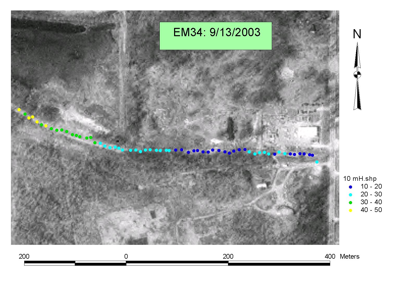
10-meter horizontal dipole shows highest conductivities near the west end of the profile. If there is shallow leachate under the area covered by this survey, the best place to seek it is near the yellow dots.
 10-meter
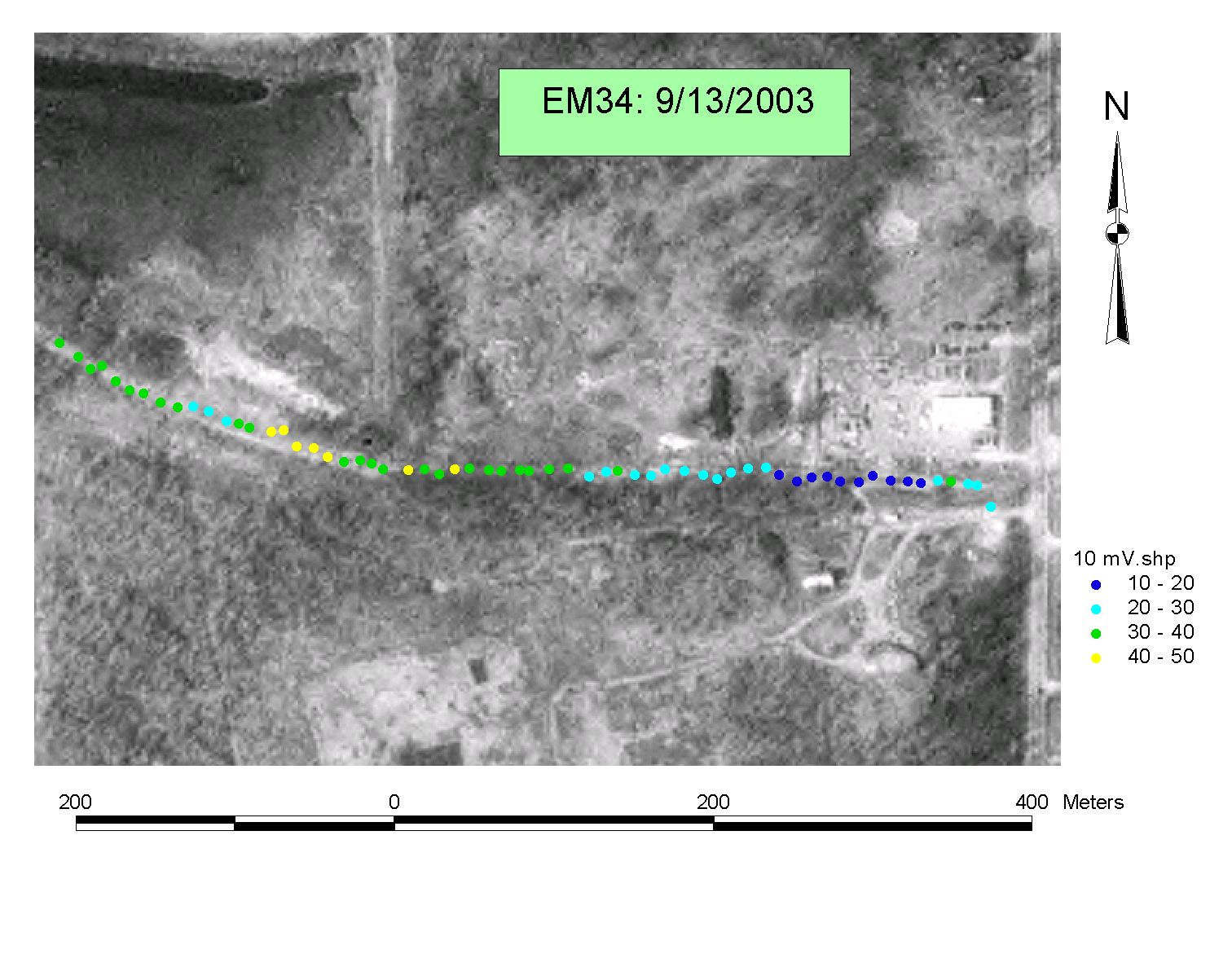
vertical dipole: looks a little bit deeper than the horizontal dipole
(check out the EM34 information link, above). If the yellow dots in the
first figure indicate leachate, the yellow dots in this figure might indicate
the leachate lies a bit deeper and to the east than that detected with the
horizontal dipole.
10-meter
vertical dipole: looks a little bit deeper than the horizontal dipole
(check out the EM34 information link, above). If the yellow dots in the
first figure indicate leachate, the yellow dots in this figure might indicate
the leachate lies a bit deeper and to the east than that detected with the
horizontal dipole.

20-meter horizontal dipole: nothing here to suggest that the interpretation to this point requires refinement.
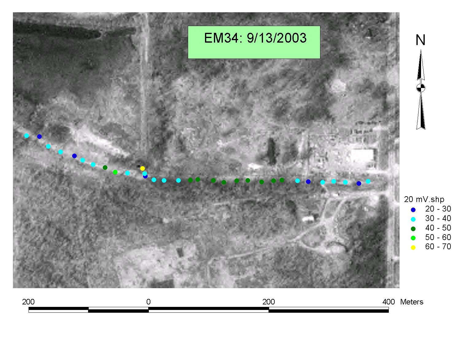 20-meter vertical dipole: Low conductivities on both east and
west ends of profile suggest shallow bedrock, with a deeper thickness of fill
over bedrock in the center of the profile.
20-meter vertical dipole: Low conductivities on both east and
west ends of profile suggest shallow bedrock, with a deeper thickness of fill
over bedrock in the center of the profile.

40-meter horizontal dipole: nothing here to suggest that the interpretation to this point requires refinement.
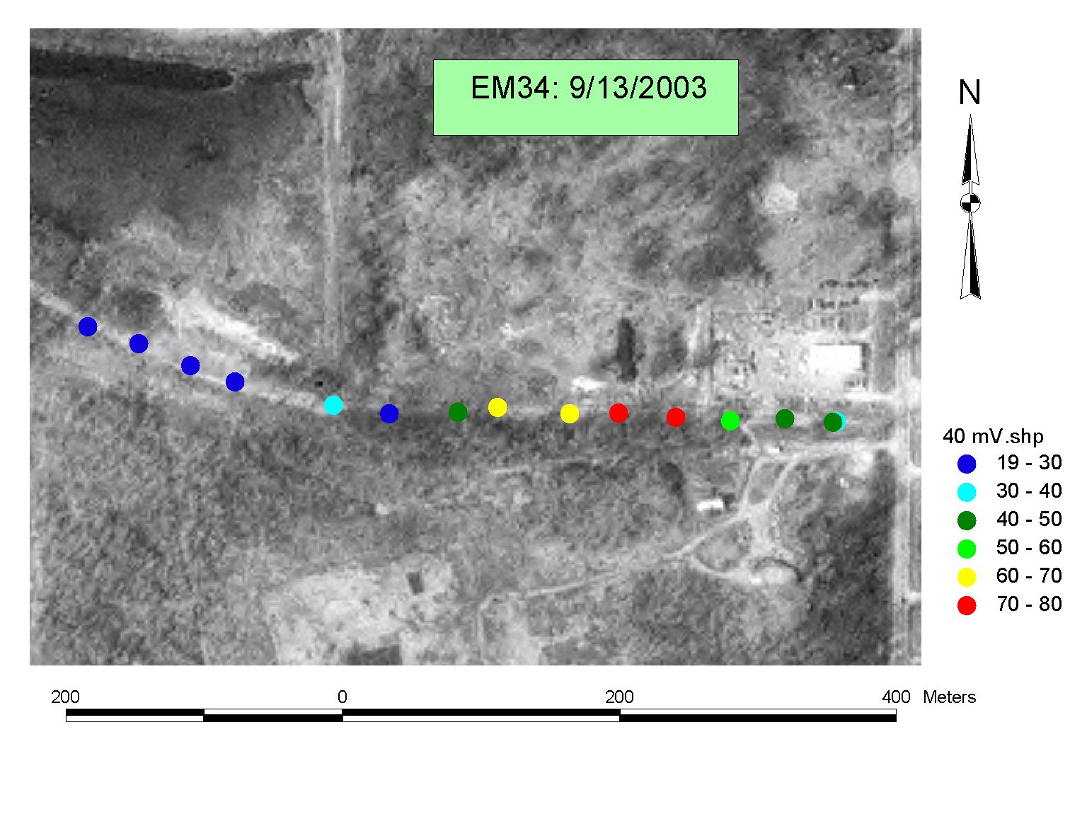 40-meter vertical dipole. Fascinating! Low
conductivities to the west suggest shallow bedrock, high conductivities left of
center (red and yellow dots) suggest something very conductive (leachate?) too
deep to pick up clearly with the 20-meter vertical dipole. These values
are higher than I've seen in most northwest Ohio glacial clays. Could
overhead power lines or other cultural conductors be responsible for generating
what looks like a contaminant "hot spot"?
40-meter vertical dipole. Fascinating! Low
conductivities to the west suggest shallow bedrock, high conductivities left of
center (red and yellow dots) suggest something very conductive (leachate?) too
deep to pick up clearly with the 20-meter vertical dipole. These values
are higher than I've seen in most northwest Ohio glacial clays. Could
overhead power lines or other cultural conductors be responsible for generating
what looks like a contaminant "hot spot"?