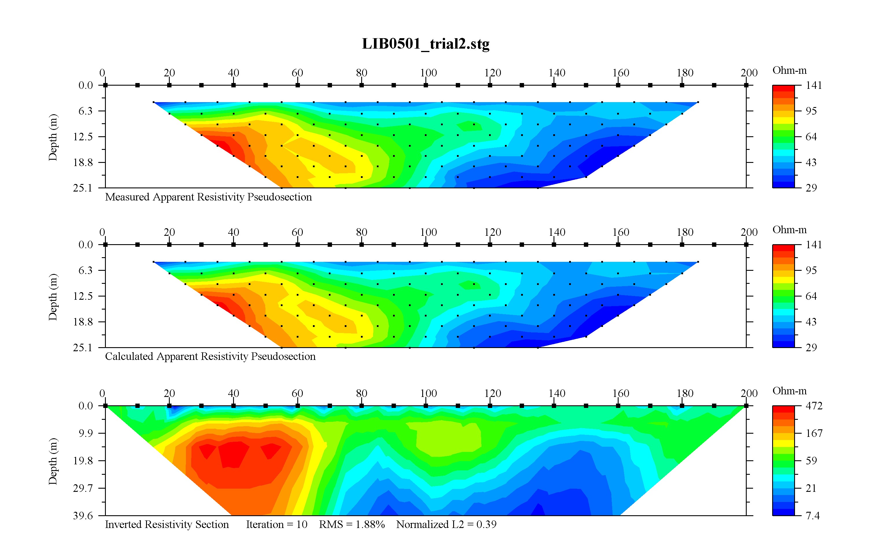
 Results
of an electrical resistivity survey west from SR 635 along the section line show
the edge of highly resistive rock (carbonate bedrock, probably) about 170 meters
west of the highway west shoulder.
Results
of an electrical resistivity survey west from SR 635 along the section line show
the edge of highly resistive rock (carbonate bedrock, probably) about 170 meters
west of the highway west shoulder.Latest news
Updated
08/19/2005
Edge of bedrock
Results
of an electrical resistivity survey west from SR 635 along the section line show
the edge of highly resistive rock (carbonate bedrock, probably) about 170 meters
west of the highway west shoulder.
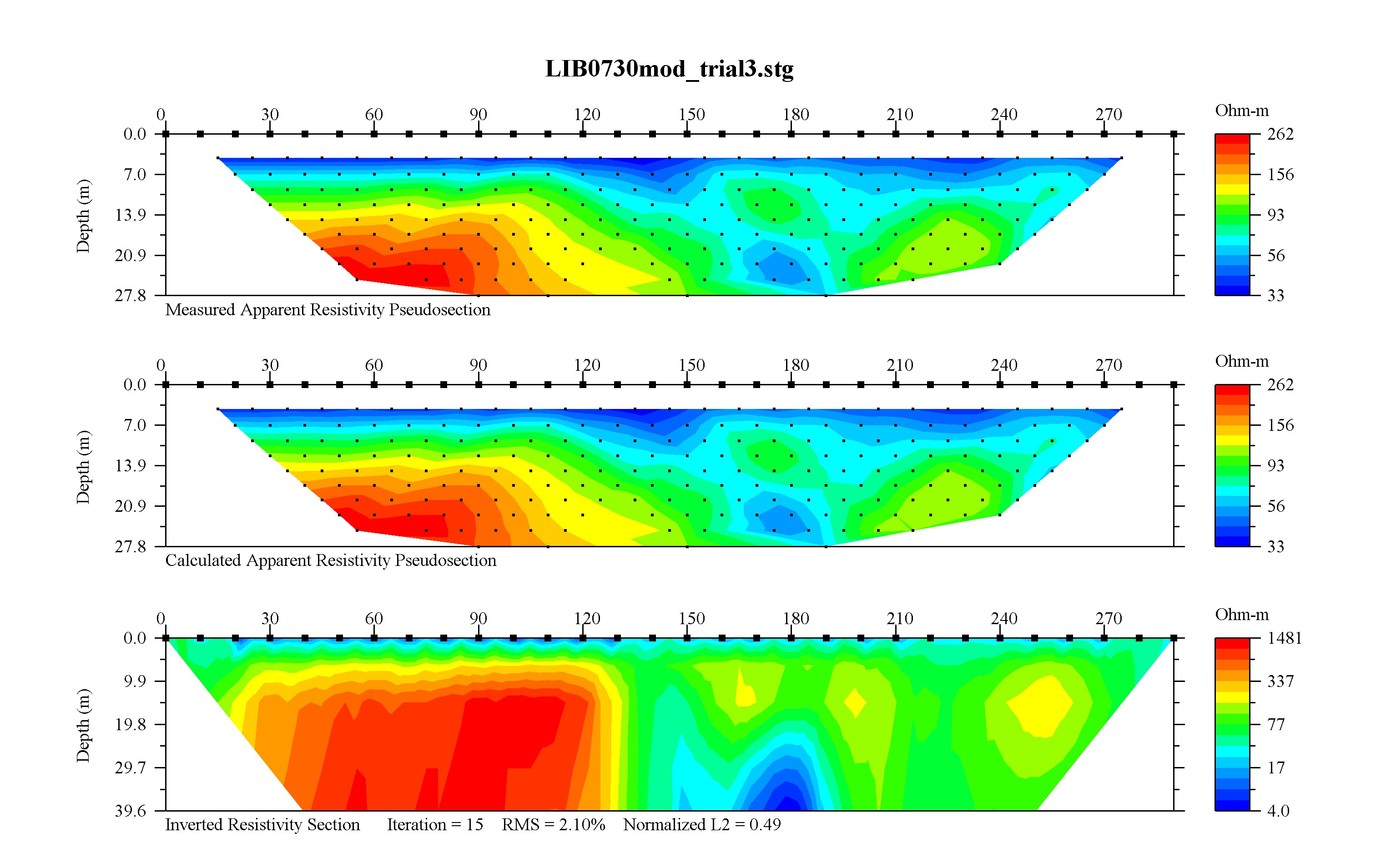
 Results
of an electrical resistivity survey run northeast from the southeast corner of a
field east of SR 635 and south of Plum Creek shows the edge of highly resistive
rock (carbonate bedrock, probably) about 70 meters northeast of the profile's
origin. Very low resistivities under the northwest (right) end of this
profile present an interesting puzzle. This anomaly may be due to salty
water found in some nearby water wells.
Results
of an electrical resistivity survey run northeast from the southeast corner of a
field east of SR 635 and south of Plum Creek shows the edge of highly resistive
rock (carbonate bedrock, probably) about 70 meters northeast of the profile's
origin. Very low resistivities under the northwest (right) end of this
profile present an interesting puzzle. This anomaly may be due to salty
water found in some nearby water wells.
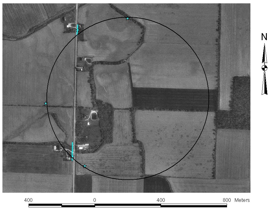
Edge of crater status image. Blue stars show locations where the edge of bedrock is known to within about 10 meters based on electrical resistivity (dipole-dipole or closely spaced Schlumberger soundings). Blue lines along SR 635 connect carbonate bedrock indicators with indicators that carbonate bedrock is absent. These data pretty much lie in a circle. Other geophysical measurements suggest that the southeast edge of the crater is not circular, that the crater is elongated toward the southeast. This reference circle is 970 meters in diameter. In comparison, Meteor Crater (Arizona) is a bit over 1200 meters in diameter. This reference circle marks our 'hypothesis' line, the target we intend to span in future geophysical surveys.
"When conducting a geophysical survey, it helps to know before you begin where the anomaly is." D. Stierman, 1996.