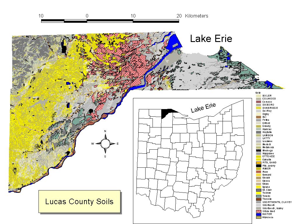
 Figure
2: USDA Soils map of Lucas County.
Sandy soils are depicted in yellow and light brown.
This map was prepared using ArcView 3.2.
Figure
2: USDA Soils map of Lucas County.
Sandy soils are depicted in yellow and light brown.
This map was prepared using ArcView 3.2.Lucas County
Soils and Elevations
Figure
2: USDA Soils map of Lucas County.
Sandy soils are depicted in yellow and light brown.
This map was prepared using ArcView 3.2.
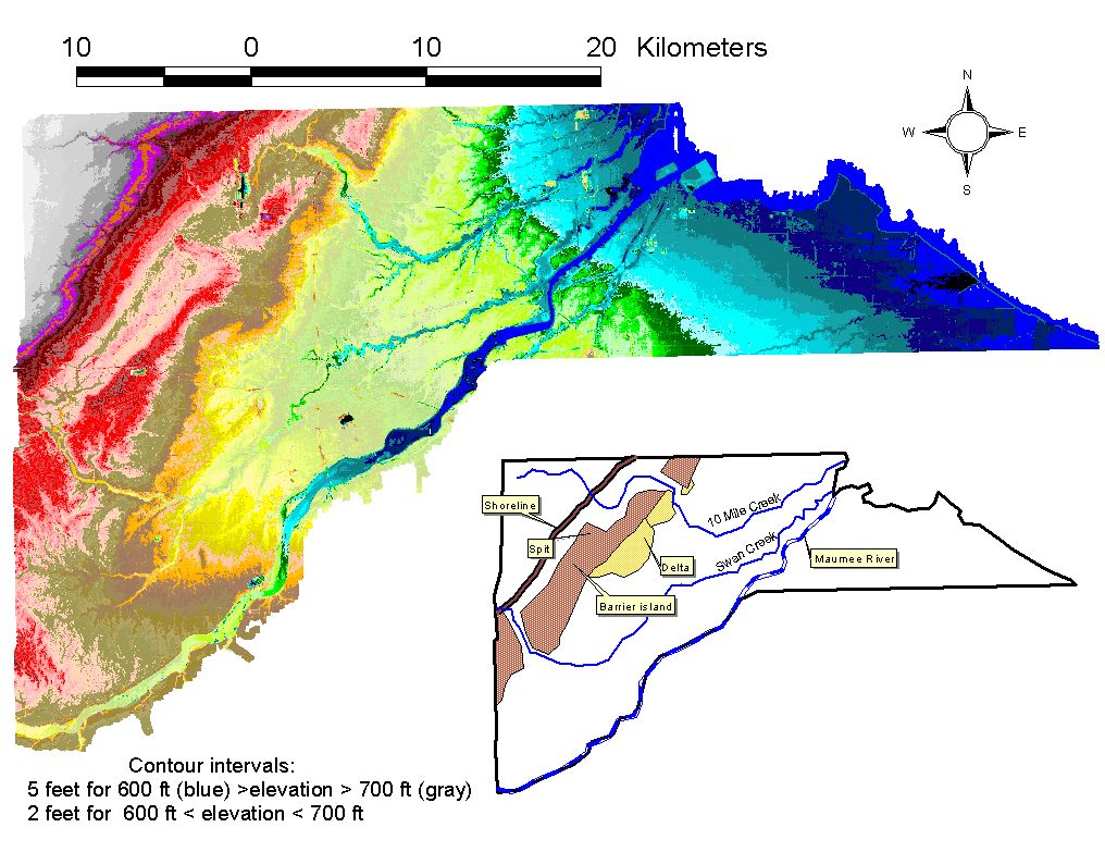 Figure
3a: DEM generated from LIDAR data collected by the
Lucas County Auditor’s Office (approximately 10 meter sample interval,
horizontal and vertical resolution approximately 20 cm).
Figure
3a: DEM generated from LIDAR data collected by the
Lucas County Auditor’s Office (approximately 10 meter sample interval,
horizontal and vertical resolution approximately 20 cm).
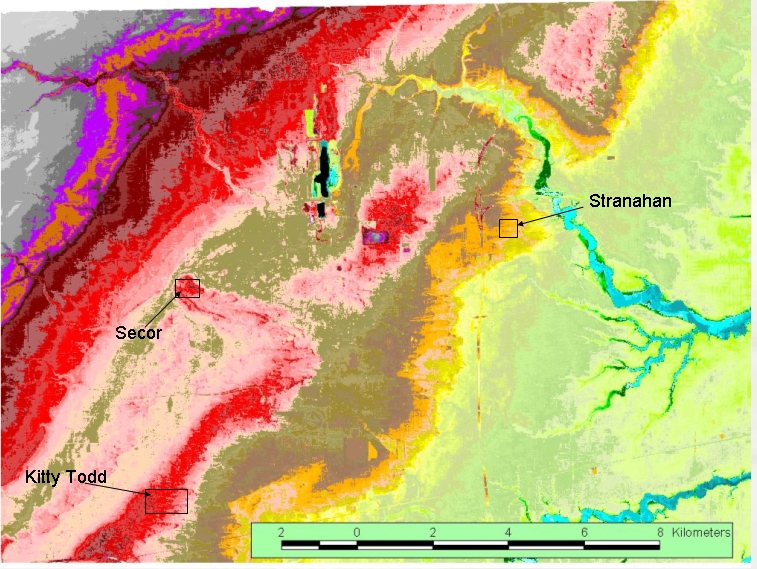 Figure
3b: Enlarged section of Lucas County DEM, north and west of the center of
Figure 3a. Survey sites at Stranahan Elementary School, Secor Metropark
and Kitty Todd Nature Reserve are shown. Perspective
views of this figure.
Figure
3b: Enlarged section of Lucas County DEM, north and west of the center of
Figure 3a. Survey sites at Stranahan Elementary School, Secor Metropark
and Kitty Todd Nature Reserve are shown. Perspective
views of this figure.