Geophysical Surveys Central
Dr. Don
Stierman - page manager
Work in progress - Updated
11/19/2004 Check
out Index Map and DEM on bottom of this page.
King Road
Electrical Resistivity
Vacant lot between landfill and Sylvania Ave.
Electromagnetic Conductivity
Oak Openings
Map showing planned GPR profile
Kitty Todd
Ground-penetrating radar, pilot study, late March, 2004
Secor Metropark
GPR, Autumn 2004 (still working on maps and captions)
Return to Phytoremediation Index
Return to Geophysical Projects index
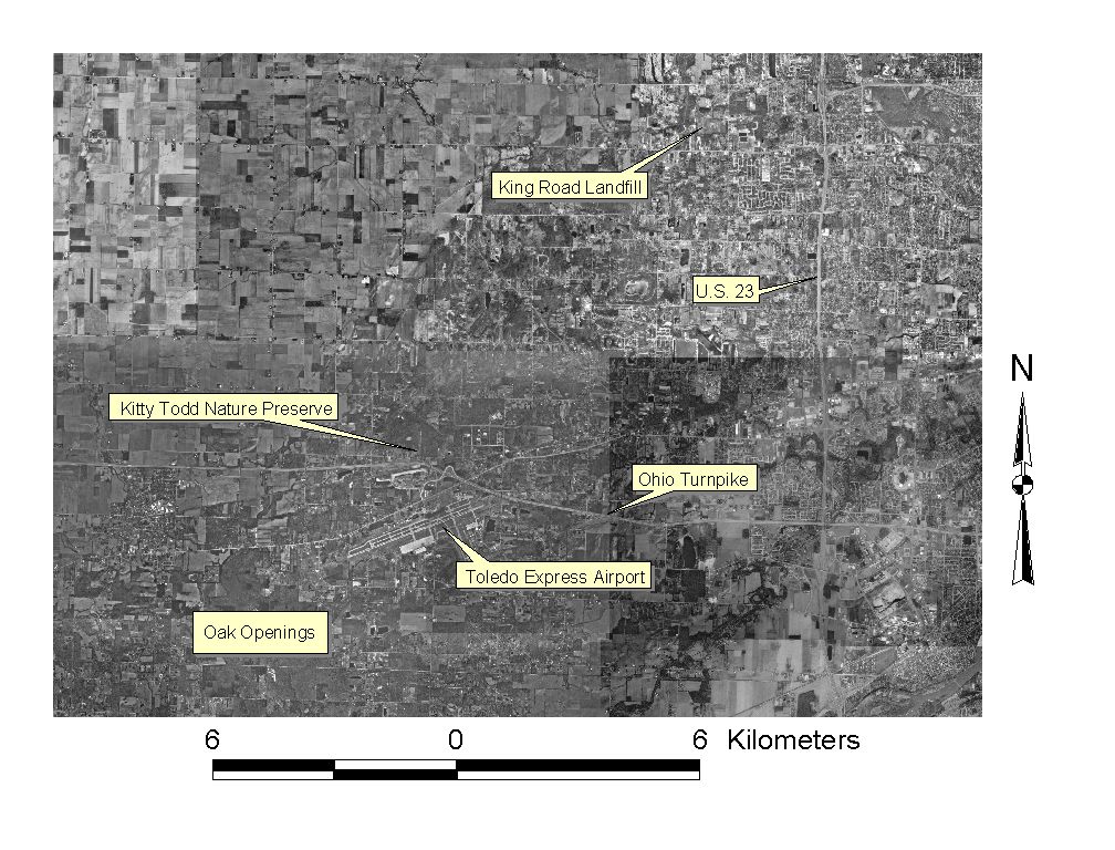
Index map sowing relative locations of study areas in western Lucas County, Ohio
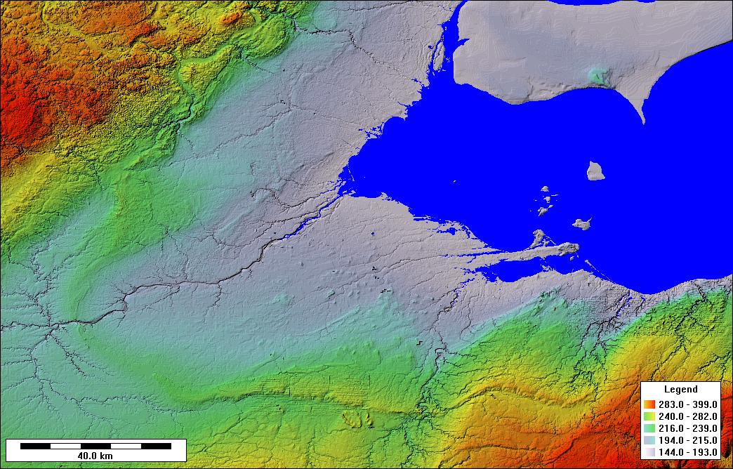 Digital
elevation model (courtesy, Tim Fisher) of northwest Ohio and southeast Michigan.
Study area lies in the west center of this image.
Digital
elevation model (courtesy, Tim Fisher) of northwest Ohio and southeast Michigan.
Study area lies in the west center of this image.
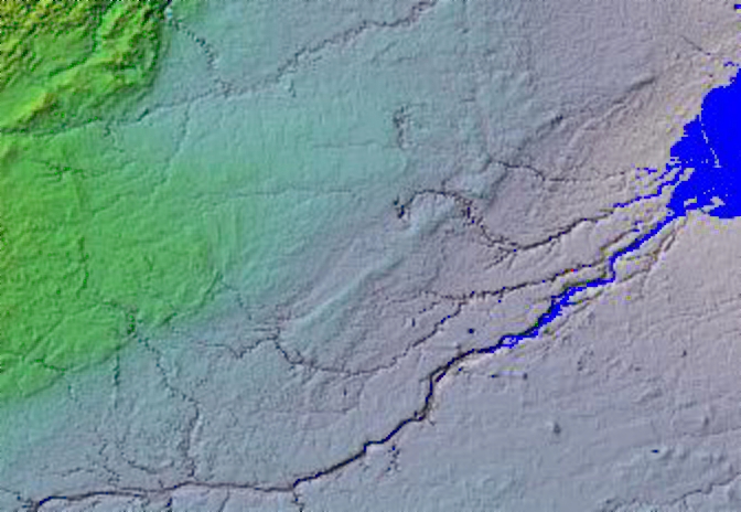
Zoom in a bit, DEM. The Oak Openings sand belt runs NE from the ne1/4, se 1/4 of the image. Swan Creek lies between the Maumee River and 10-Mile Creek.