Saugatuck Michigan GPR Profiles
{
Click on the thumbnail to view the high-resolution GPR profile }
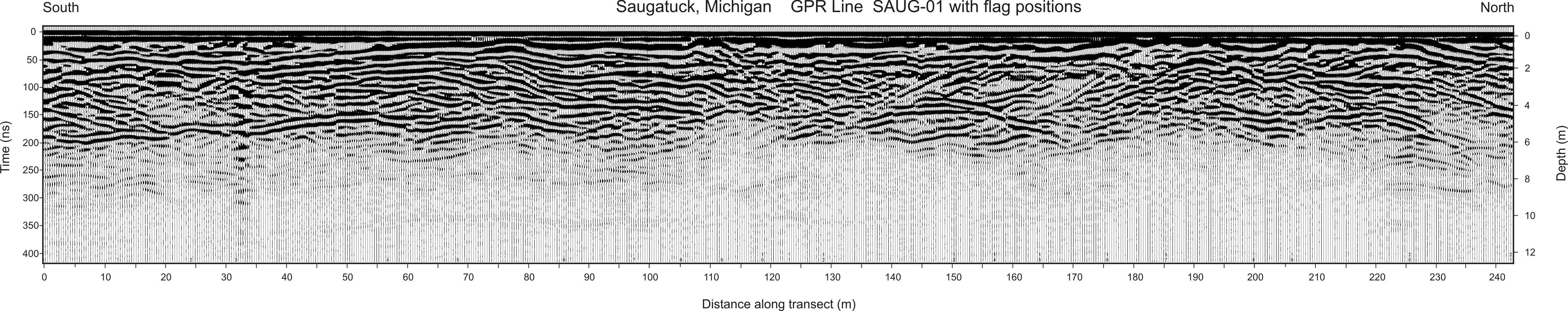
SAUG-01
South to North
File: SAUG-01.comments.jpg
showing flag positions (comments)
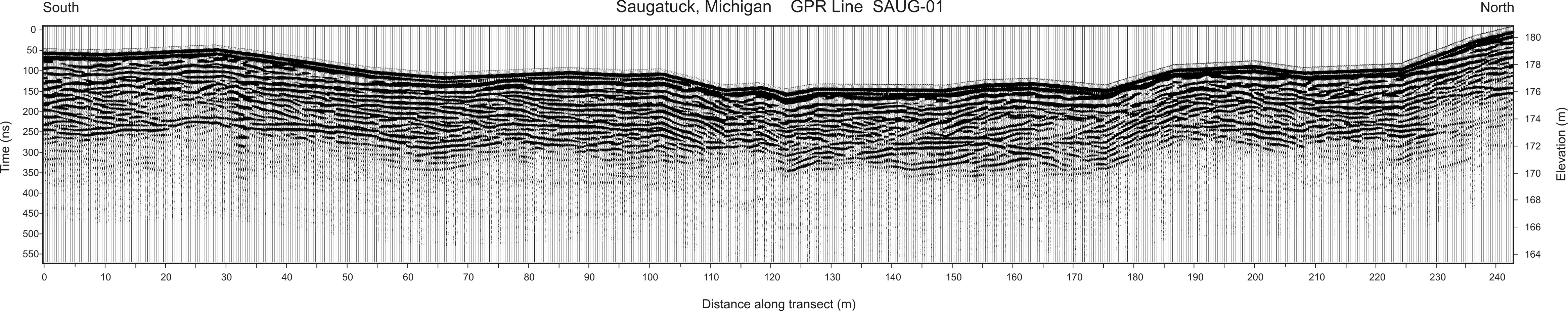
File: SAUG-01.topo_SL.jpg
topographic correction with elevations relative to sea level
SAUG-02
South to North
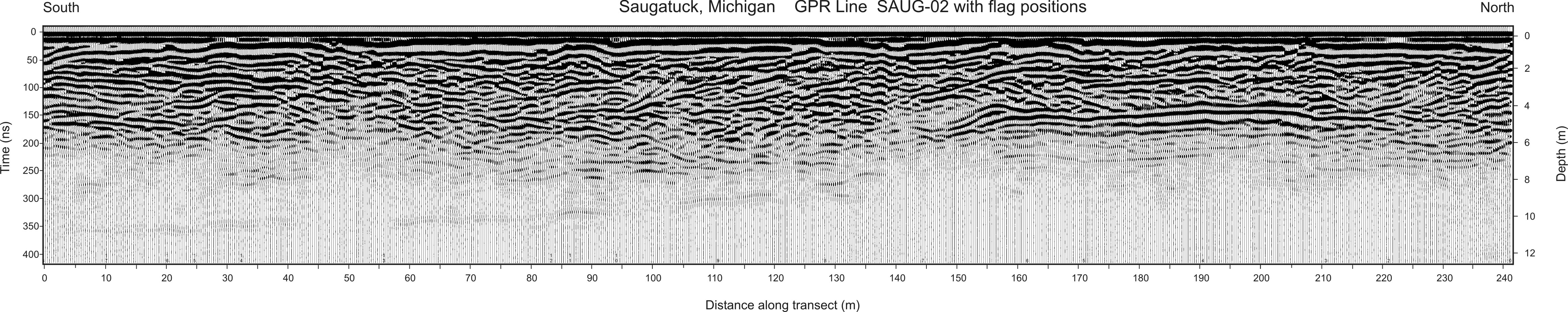
File: SAUG-02.comments.jpg
showing flag positions
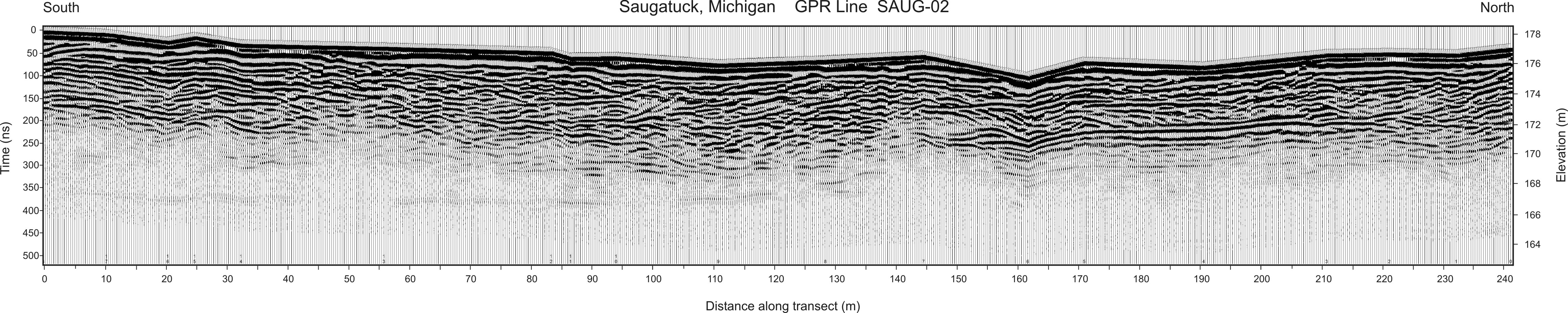
File: SAUG-02.topo_SL.jpg
topographic correction with elevations relative to sea level
SAUG-03
West to East
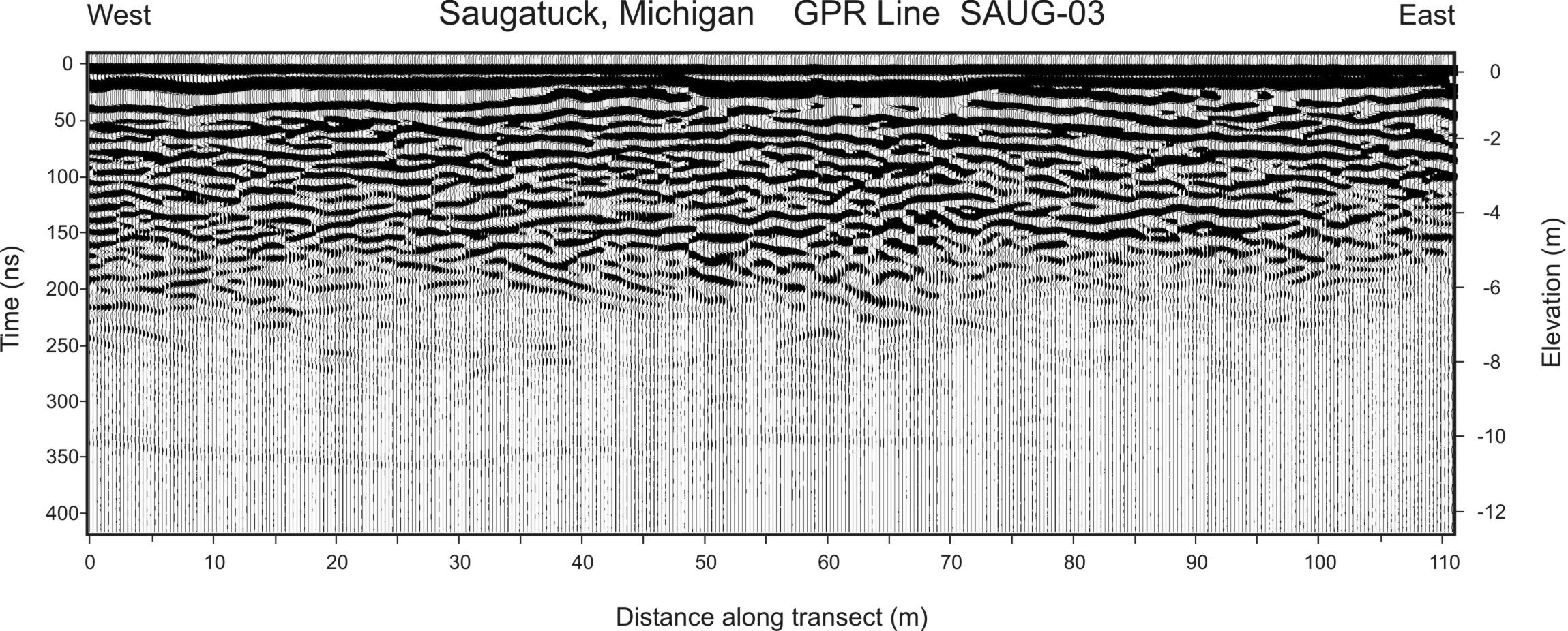
File: SAUG-03.jpg
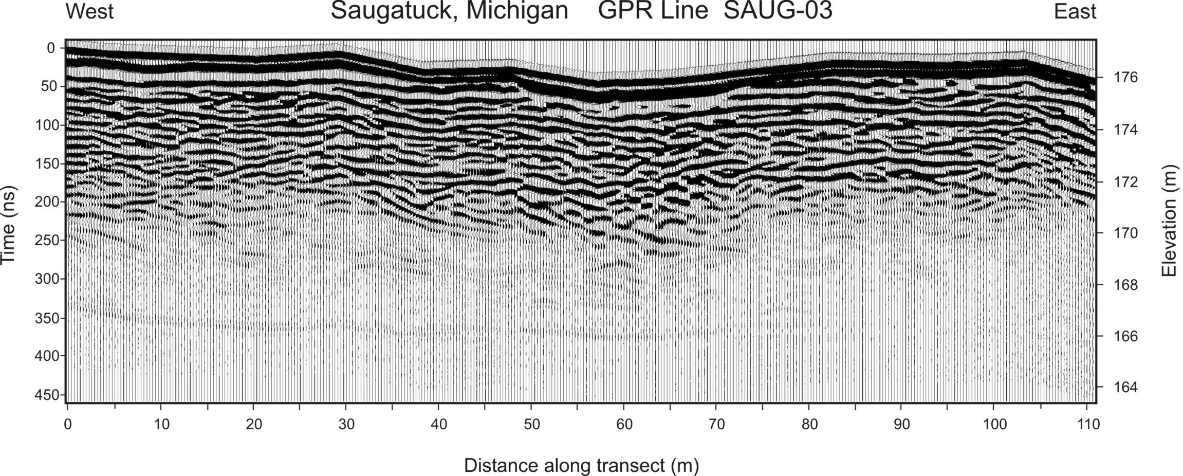
File: SAUG-03.topo_SL.jpg
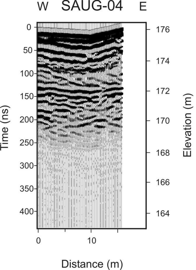
SAUG-04
West to East
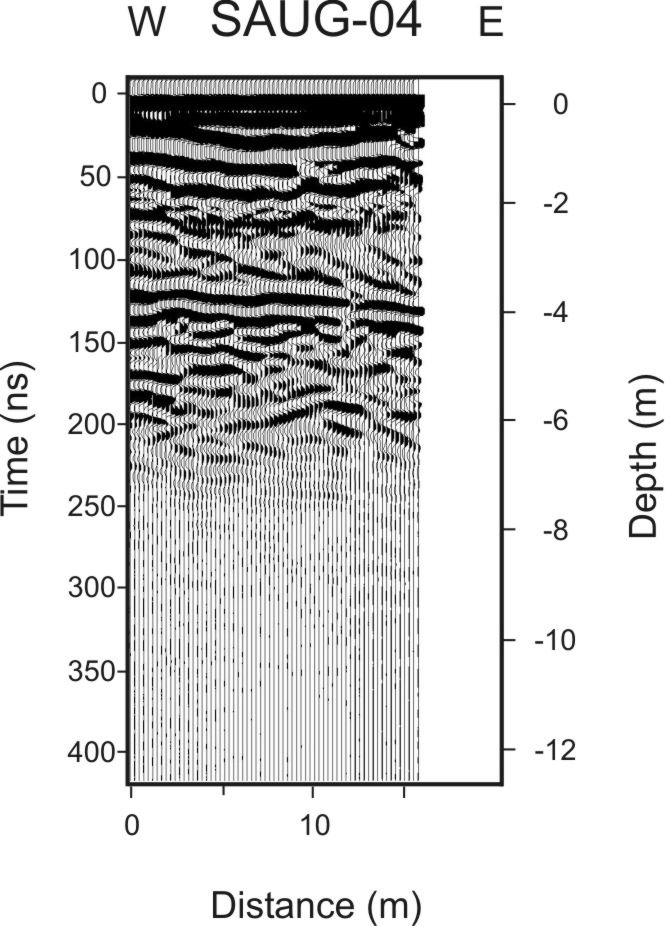
File: SAUG-04.jpg
File: SAUG-04.topo_SL.jpg
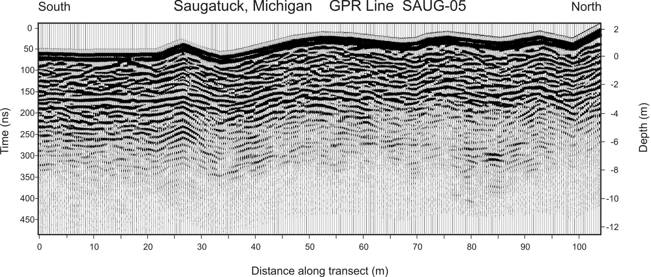
SAUG-05
South to North along crest of primary dune
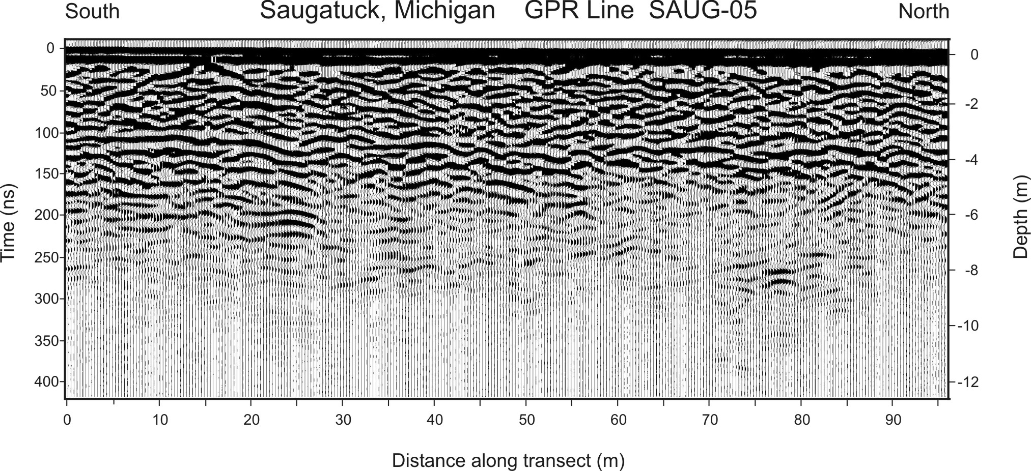
File: SAUG-05.jpg
File: SAUG-05.topo.jpg
SAUG-06
South to North along the beach
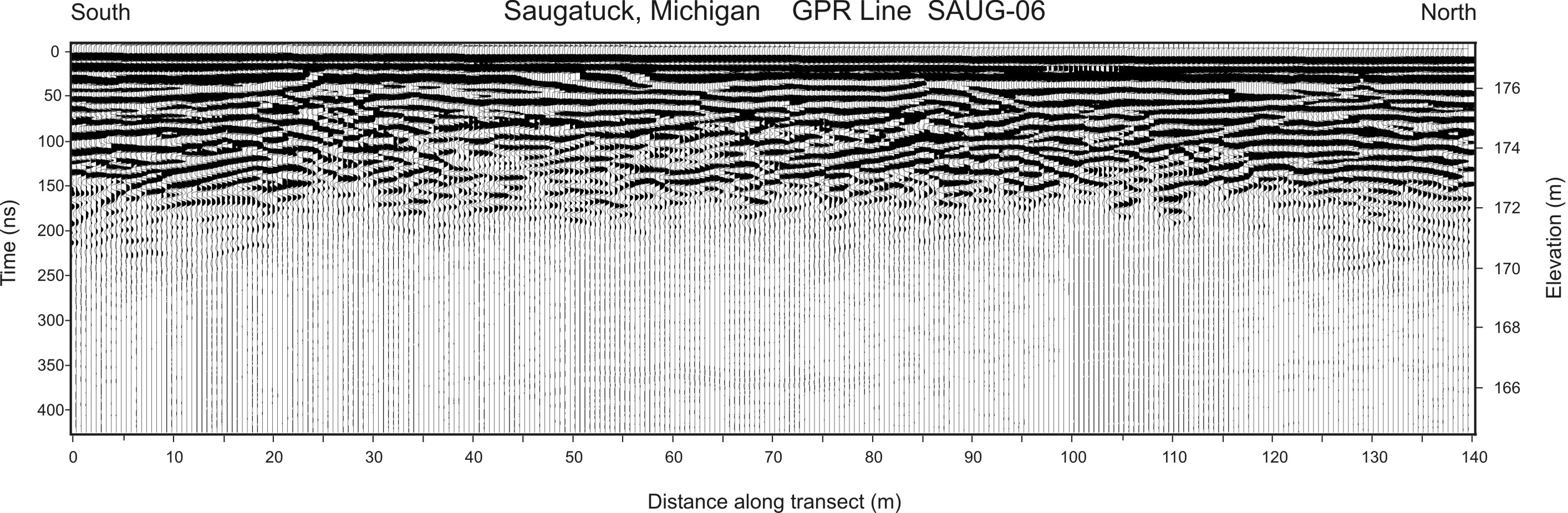
File: SAUG-06.topo_SL.jpg