TURIN PAPYRUS MAP FROM ANCIENT
EGYPT
by
James A. Harrell, Ph.D.
Professor of Geology
Department of Environmental
Sciences
The University of Toledo
2801 West Bancroft St.
Toledo, Ohio 43606-3390, USA
(james.harrell@utoledo.edu)
DISCOVERY and
reconstruction OF THE MAP
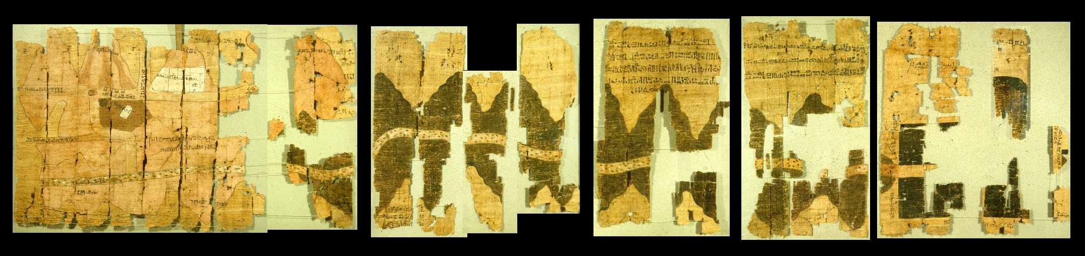
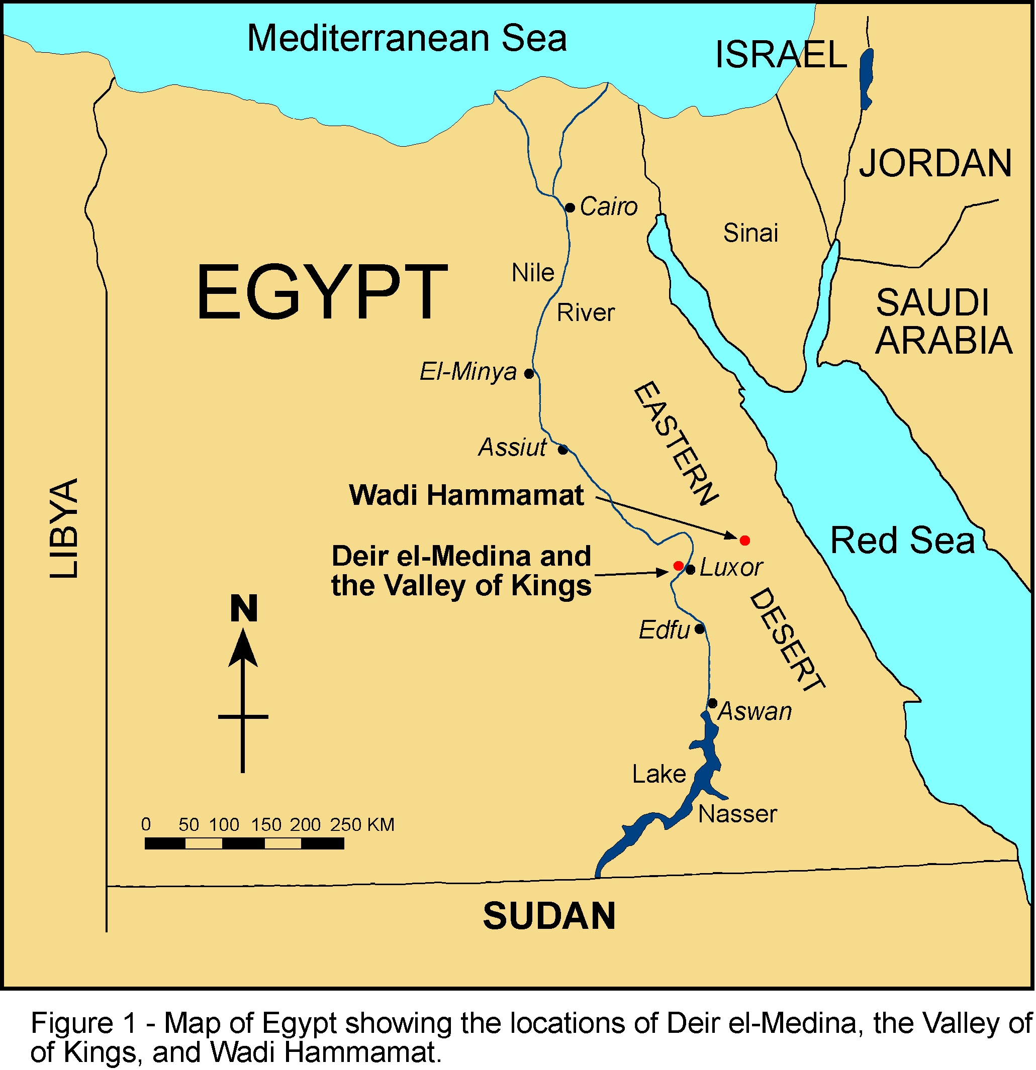
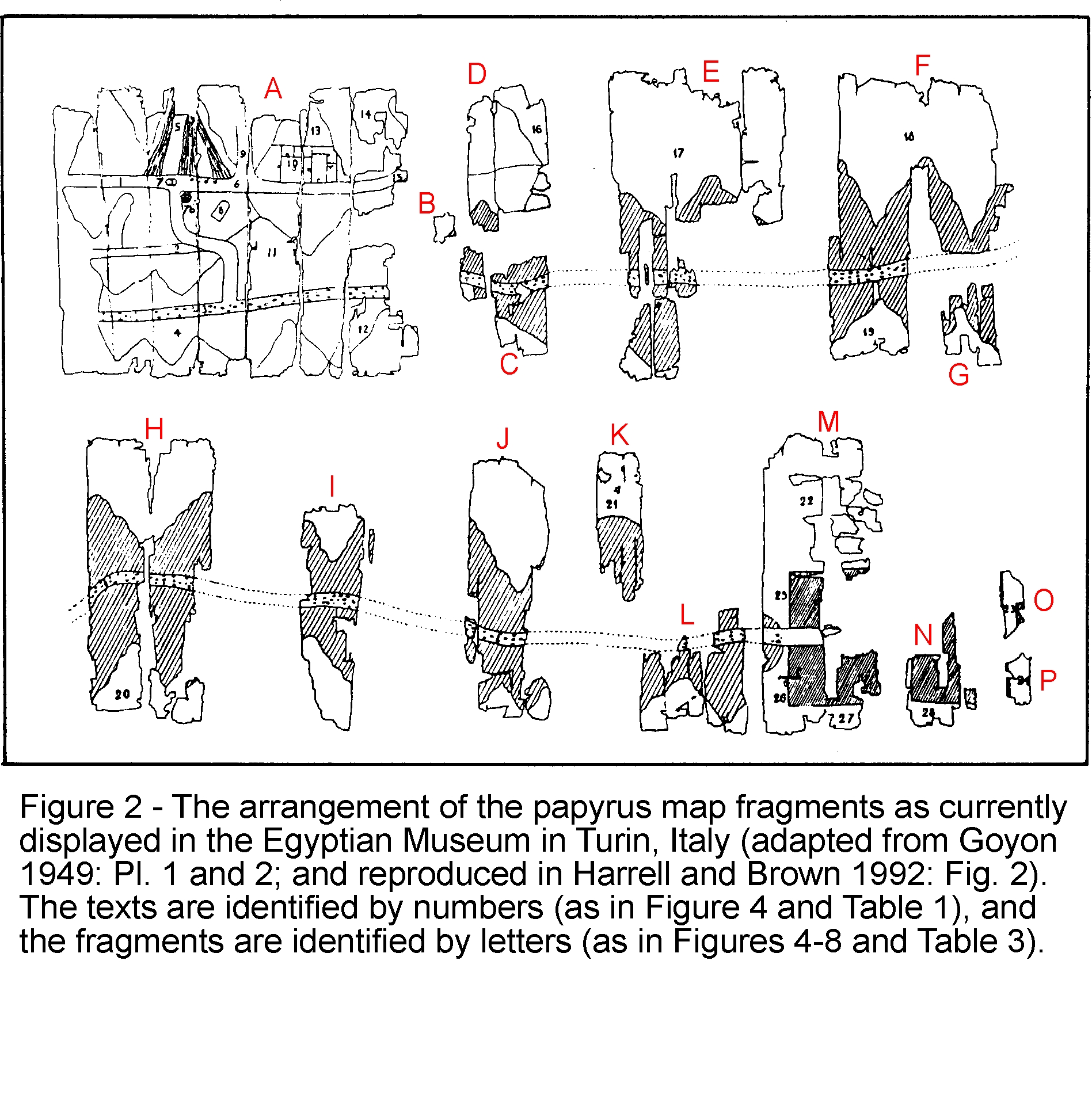
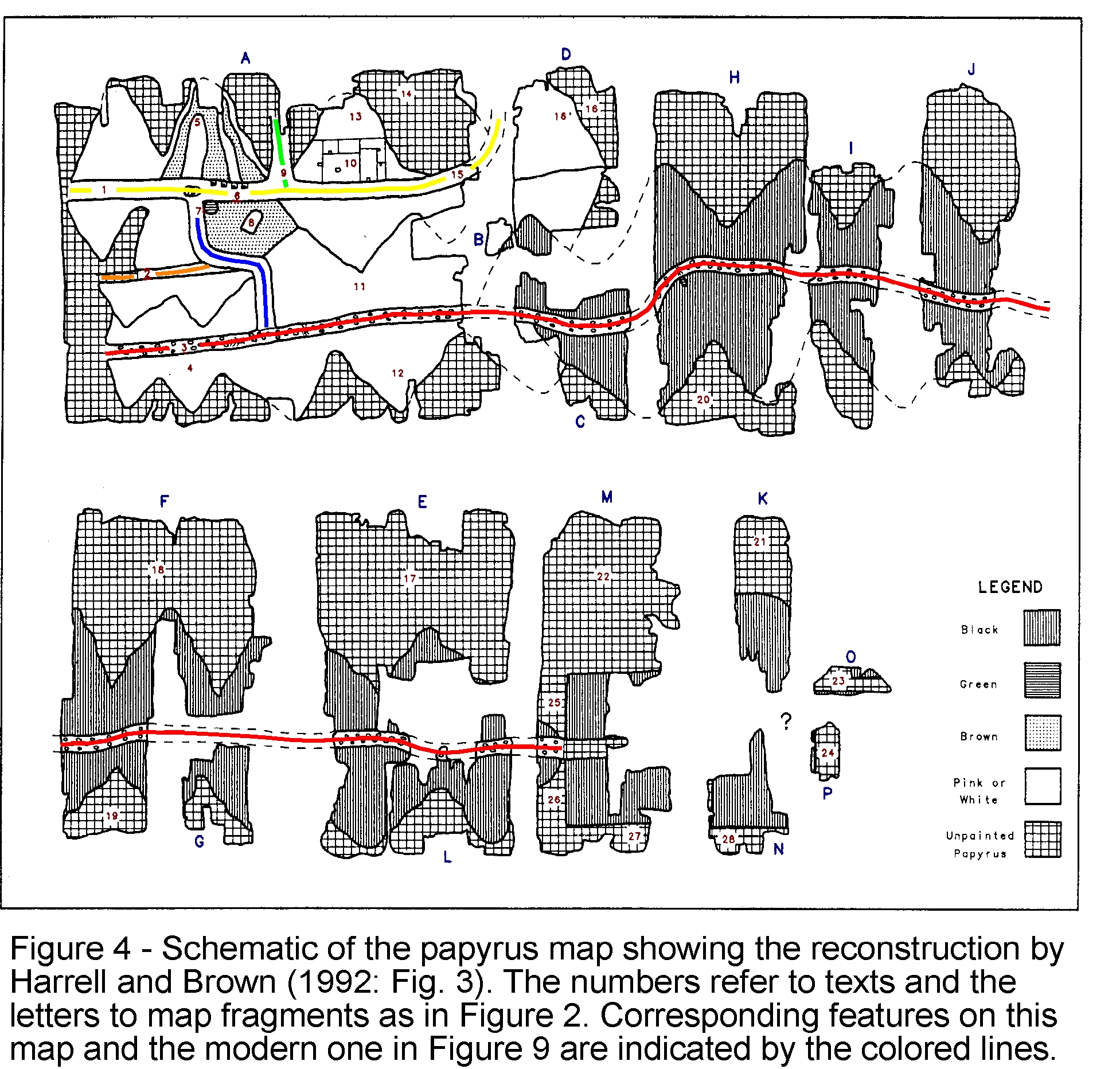
An ancient Egyptian map drawn on a scroll of papyrus paper was discovered between 1814 and 1821 by agents of Bernardino Drovetti, the French Consul General in Egypt. The map came from a private tomb in the ancient village of Deir el-Medina, near the modern-day city of Luxor (ancient Thebes) in Egypt (Figure 1). This village housed the workers responsible for excavating and decorating the royal tombs of the Egyptian New Kingdom (1539-1075 BC) in the nearby Valley of Kings and Valley of Queens. Soon after it was found, the map was sold to king Charles Felix, ruler of the northern Italian Kingdom of Sardenia and Piedmont. In 1824, this king established the Egyptian Museum in Turin, the kingdom’s capital, and here the map has resided ever since. The many map fragments were originally considered parts of three separate papyri that were designated as ‘Papyrus or P. Turin’ 1869, 1879 and 1899. Most of these fragments were eventually recombined to form a single map about 280 cm long by 41 cm wide (Figure 2).
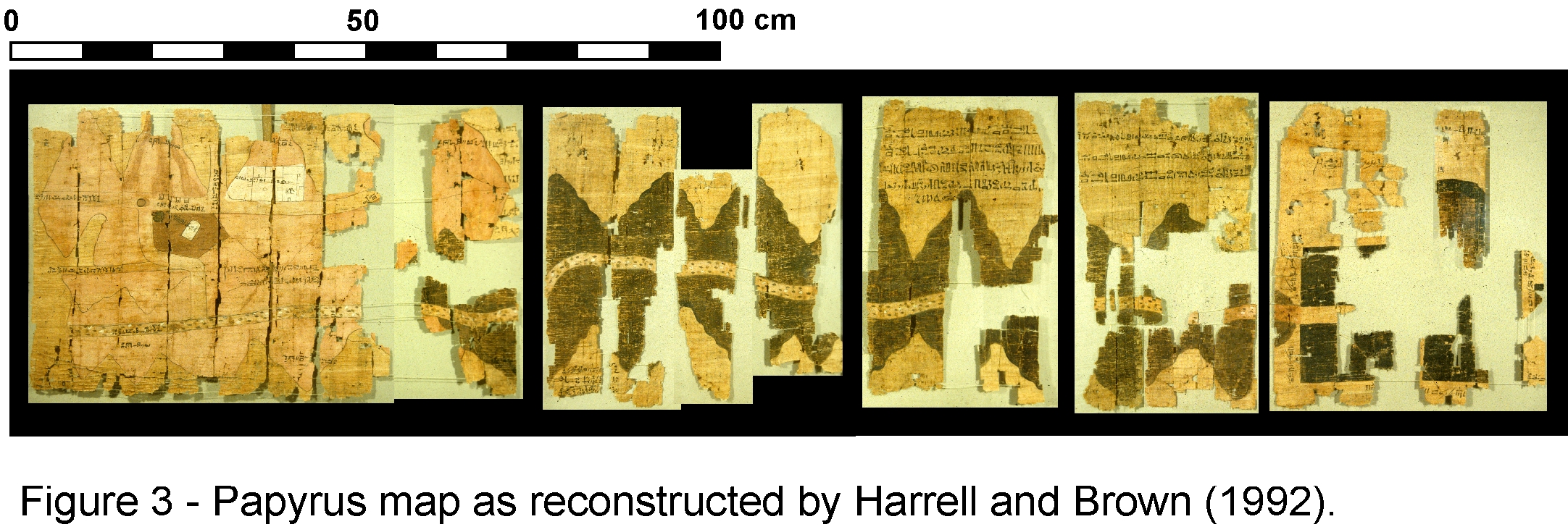
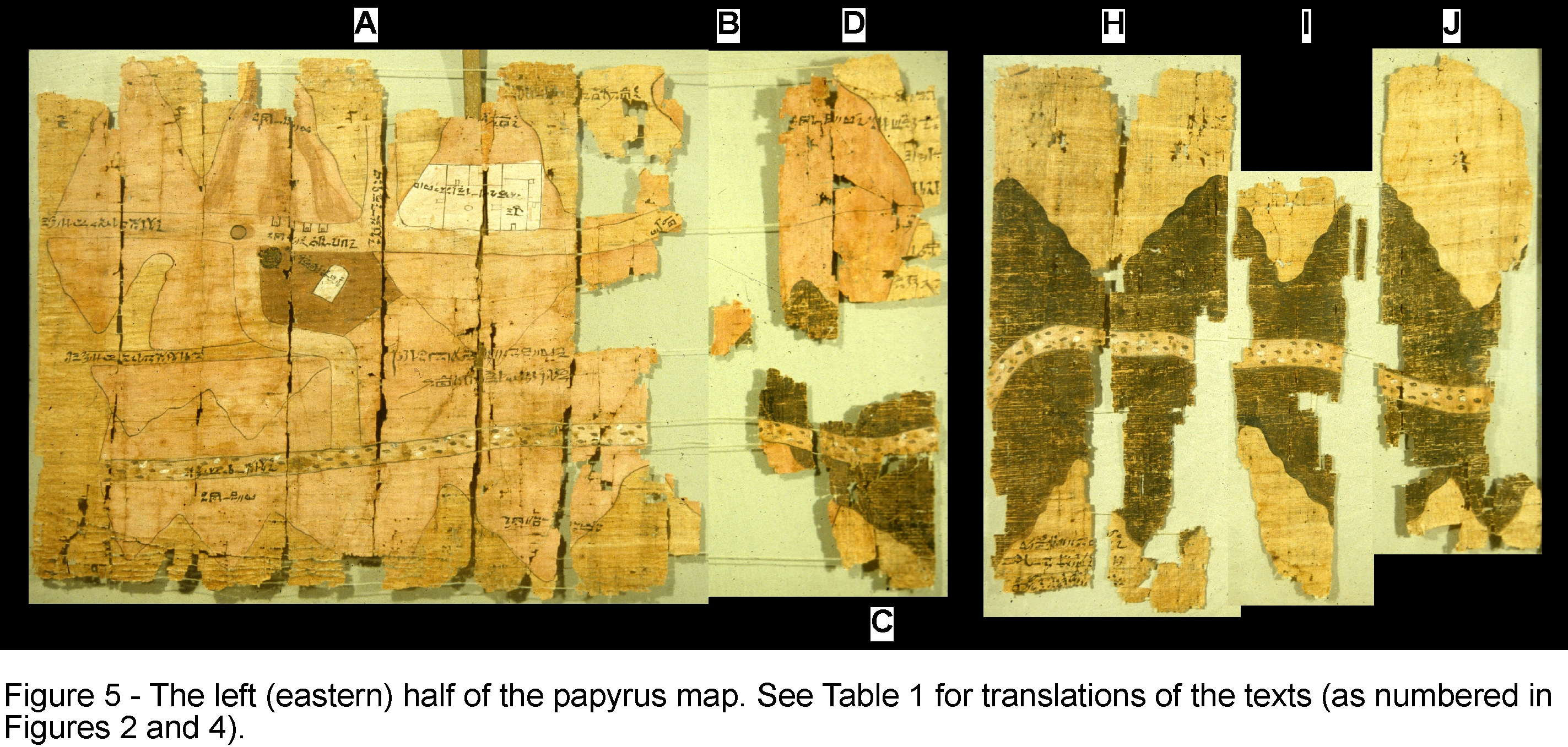
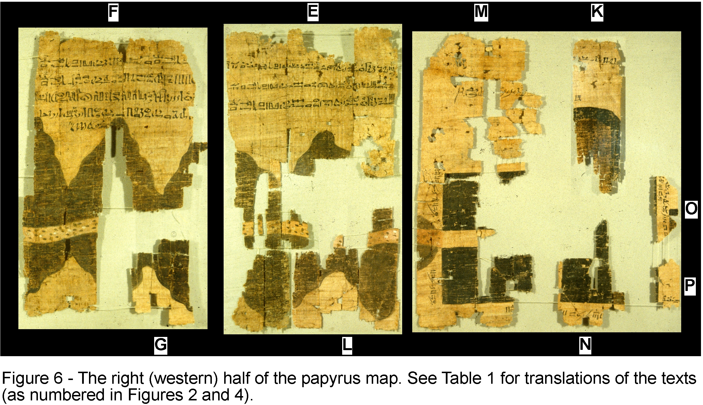
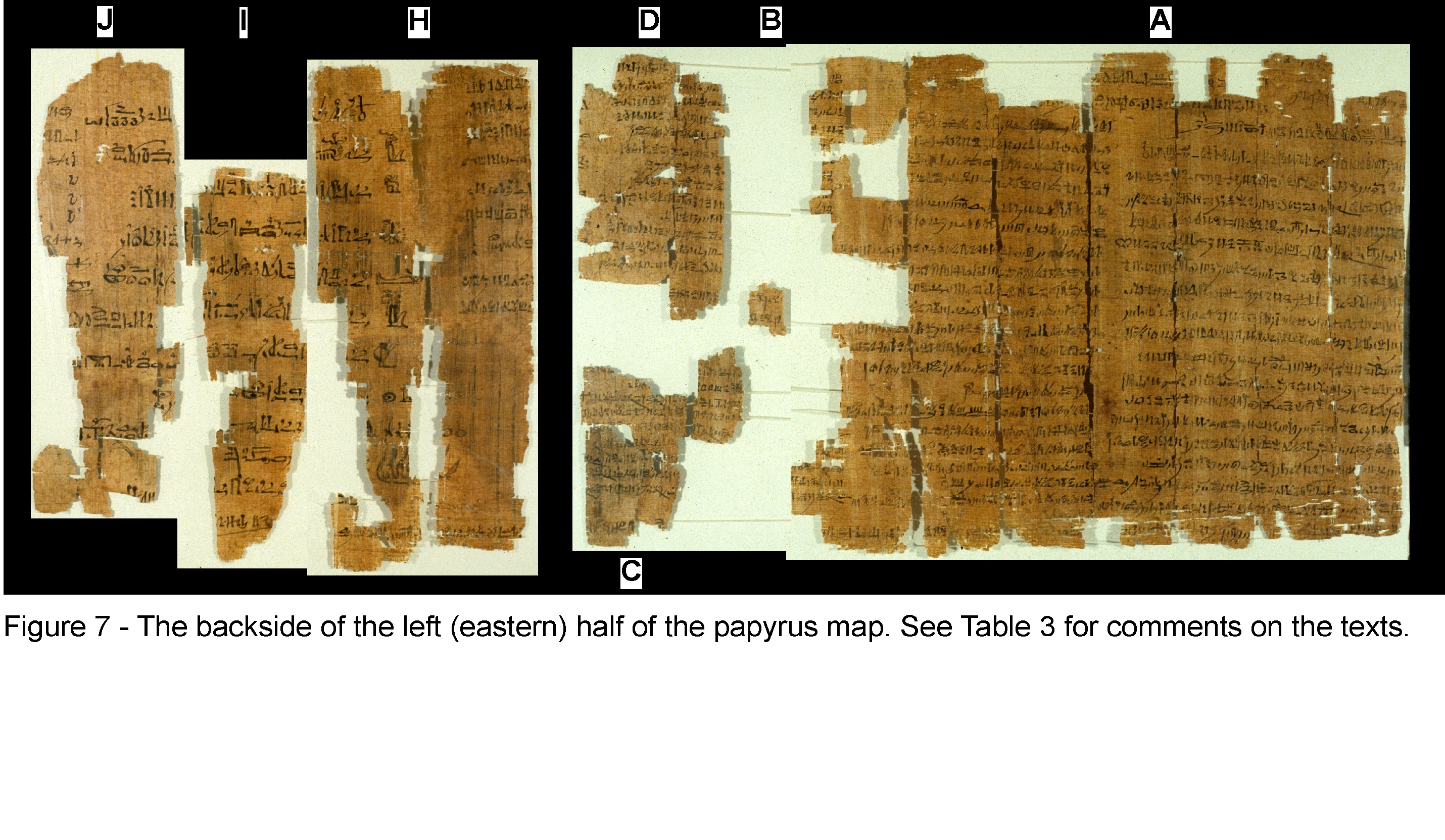
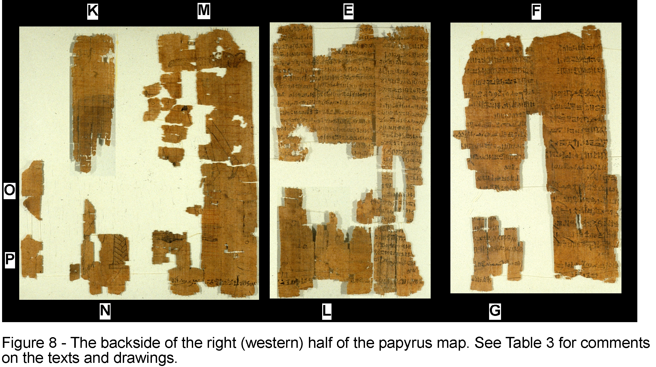
The current reconstruction of the map in the Egyptian Museum, which dates to the early 1900’s, is incorrect in several of its details. A new arrangement of the map fragments has been proposed and this is shown in Figure 3, Figure 4, Figure 5 and Figure 6. The principal changes are the transposition of map fragments H-J and E, the placement of L at the bottom of E, and the narrowing of gaps between many of the fragments (which shortens the map to about 210 cm). This new reconstruction is consistent with the requirements that: (1) the adjoining fragments should correlate closely in terms of the features drawn on the map side, the texts and drawings on the map’s backside (Figure 7 and Figure 8), and the fiber patterns in the papyrus paper; (2) the width of the fragments and the spacing between the breaks within them should match for those fragments that are vertically juxtaposed; and (3) the topography and geology of the area shown on the map should be taken into account. Figure 3, Figure 5, Figure 6, Figure 7 and Figure 8 are computer-generated photo-mosaics derived from digital scans of photographs taken of the papyrus.
The map was rolled up when discovered and
subsequently handled, and this explains the especially poor preservation of the
rightmost portion in Figure 3, which formed the outer abraded surface of the
scroll. An unknown amount of the papyrus has been lost at its right edge and so
fragments K and N-P cannot be correctly placed. The map is not truncated here,
but drawings of an unknown number of stone blocks and the accompanying texts
are missing. The Egyptian Museum has many small map fragments that it left out
of its reconstruction (and are also missing from Figures 3-8) and eventually
these ‘pieces of the puzzle’ will be added to create a more complete map.
TOPOGRAPHIC AND GEOLOGIC CONTENT OF THE MAP
The Turin papyrus map is notable for
being the only topographic map to survive from ancient Egypt and also for being
one of the earliest maps in the world with real geographic content. Although
there are a few older topographic maps from outside Egypt, they are all quite
crude and rather abstract in comparison to the relatively modern-looking map
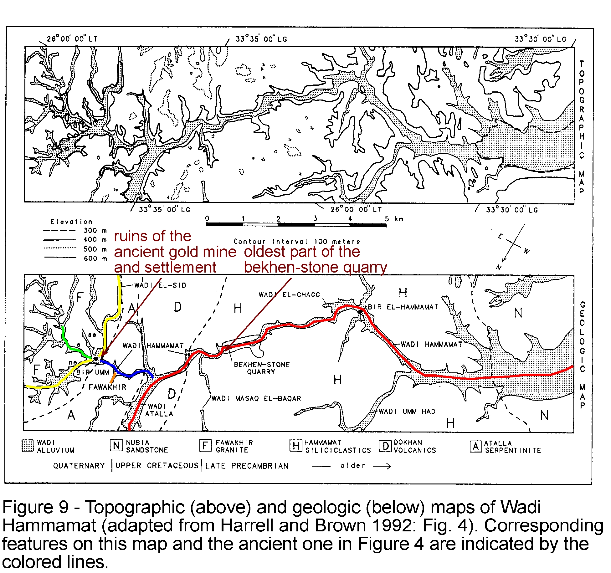
drawn on the Turin papyrus. This map shows a 15 km stretch of Wadi Hammamat
(‘Valley of Many Baths’) in the central part of Egypt’s Eastern Desert (Figure
1). The top is oriented toward the south and the source of the Nile River with
west on the right side and east to the left. There is no constant scale used on
the map, but by comparison with the actual distances in Wadi Hamamat it is
evident that the scale varies between 50 and 100 m for each 1 cm on the map.
The topography and geology of the Wadi Hammamat area are shown in Figure 9. The corresponding features on the ancient and modern maps are indicated by the colored lines in Figure 4 and Figure 9. From the good agreement between these maps, it can be seen that the papyrus clearly depicts Wadi Hammamat’s long course and eventual confluence with wadis Atalla and el-Sid, the surrounding hills (shown as stylized conical forms with wavy flanks that are laid out flat on both sides of the valleys), the quarry for bekhen-stone, and the gold mine and settlement at Bir Umm Fawakhir (‘Well of the Mother of Pottery’). Bekhen-stone (geologically, metagraywacke sandstone and siltstone) is a beautiful grayish-green ornamental stone that was highly prized by the ancient Egyptians. The only quarry was in Wadi Hammamat, and this was worked sporadically from the Early Dynastic period through Roman times (about 3000 BC to 400 AD). The gold mine at Bir Umm Fawakhir was active during the New Kingdom and again in the Ptolemaic through Early Byzantine periods (about 1500 BC to 600 AD).
Fragment A shows five cultural
features associated with the gold-mining settlement, including: four houses, a
temple dedicated to the God Amun (the large white area subdivided by walls), a
monument stone honoring king Sety I (1290-1279 BC of the New Kingdom’s 19th
Dynasty), a water reservoir, and, at the confluence of wadis Hammamat and
el-Sid, a water well with an encircling wall that casts a shadow on its right
side. The brown patch of ground opposite the settlement may represent an area
where either mine tailings were dumped or farming was practiced.
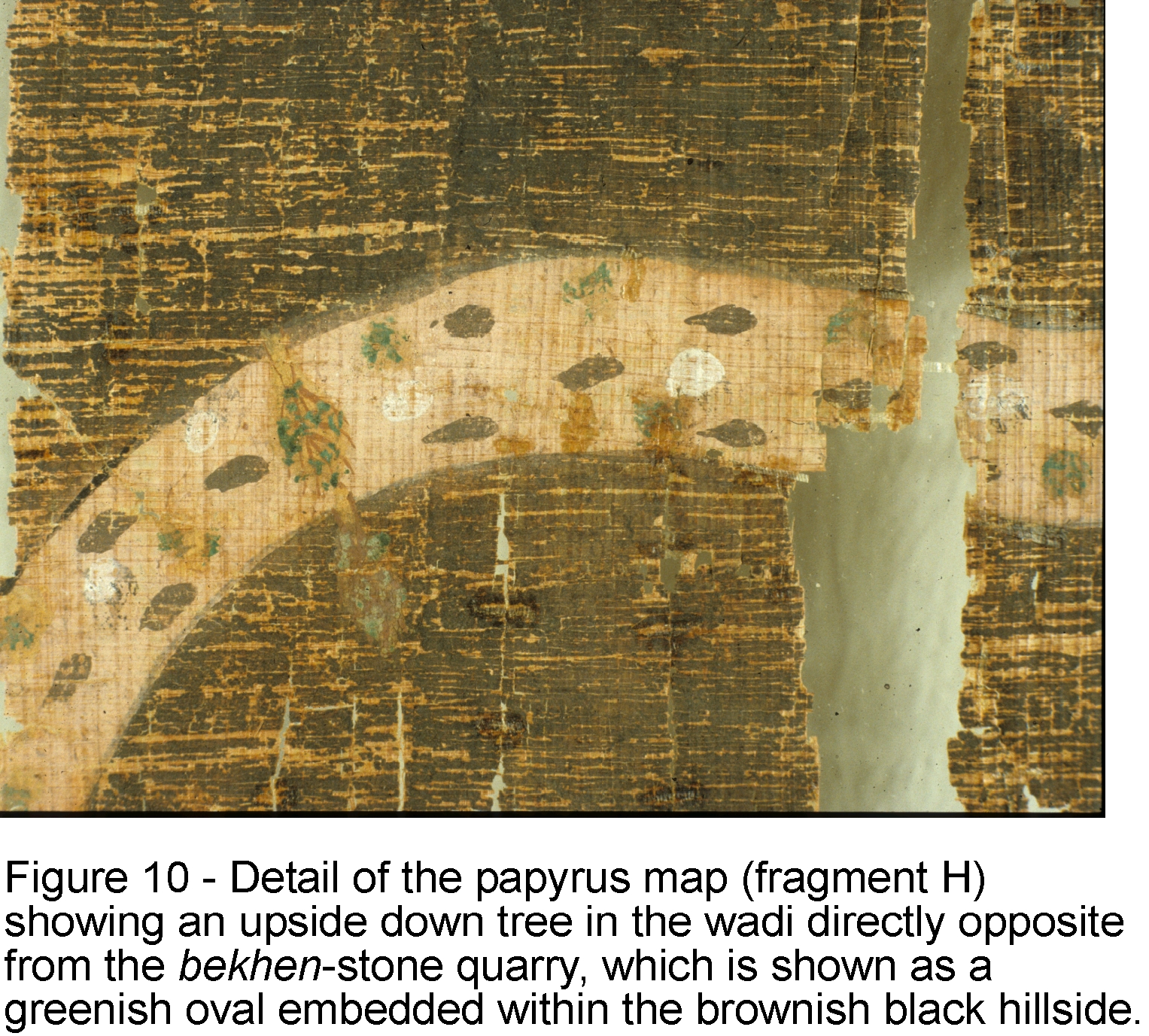
On map fragments A and H, within the main valley represented by multi-colored dots, there are three small drawings of trees, which from their form can be identified as Tamarisks. The tree on fragment H (Figure 10), which is drawn upside-down, is just opposite the bekhen-stone quarry (the green oval at the base of the brownish black hill) and at the center of the sharp bend in the valley. On the ancient map, this is the only major bend in Wadi Hammamat prior to its confluence with Wadi Atalla. As seen in Figure 9, however, Wadi Hammamat actually has many sharp bends as well as wide meanderings. Because the ancient map was drawn on a papyrus scroll, which would have resembled a modern roll of paper towels, the author did not have the freedom to show the true wandering course of Wadi Hammamat and so included only the most important bend, the one near the bekhen-stone quarry.
The papyrus map also has numerous annotations written in hieratic script (the cursive form of hieroglyphic writing) that identify the features shown on the map (see Table 1 for translations), including: the destinations of the valley routes (texts 1-3, 9 and 16 on fragment A), the distance between the bekhen-stone quarry and gold mine (text 17 on fragment E), the location of gold deposits in the hills (texts 4-5, 11-12 and 16’ on fragments A and D), the gold-mining settlement (texts 6-8 and 10 on fragment A), the bekhen-stone quarry (text 20 on fragment H), and the sizes of the quarried bekhen-stone blocks (texts 23 and 25-28 on fragments M-P). Text 18 on fragment F is especially important for understanding the purpose of the map because it refers to a bekhen-stone quarrying expedition and the destination of the quarried blocks.
Besides being a topographic map of surprisingly modern aspect, the Turin papyrus is also a geologic map because it accurately shows the geographic distribution of different rock types (the black hills with Hammamat siliciclastics, and the pink hills with Dokhan volcanics, Atalla serpentinite and Fawakhir granite) and the lithologically diverse wadi gravel (the brown, green and white dots within the main valley that represent different kinds of rocks), and it also contains information on quarrying and mining (see Table 2 for a description of the geologic units). Additionally notable are the representation of iron-stained, gold-bearing quartz veins with three radiating bands on the pink hill above the gold-mining settIement on fragment A (beneath text 5), and text 11 on fragment A, which reads very much like a legend on modern geologic maps by explaining what the pink coloring represents. The Turin papyrus is the oldest known geologic map in the world and it is all the more remarkable considering that it would be another 2900 years before the next geologic map was made and this was in France during the mid-1700’s. There is no reason to think, however, that the ancient author intentionally set out to make a geologic map. From the colors used for the hills and wadi gravel, it is evident that he merely drew what he literally saw in the desert – the real hills and surface gravels have the same general colors as those on the map (Table 2).
THE MAP’S AUTHOR AND PURPOSE
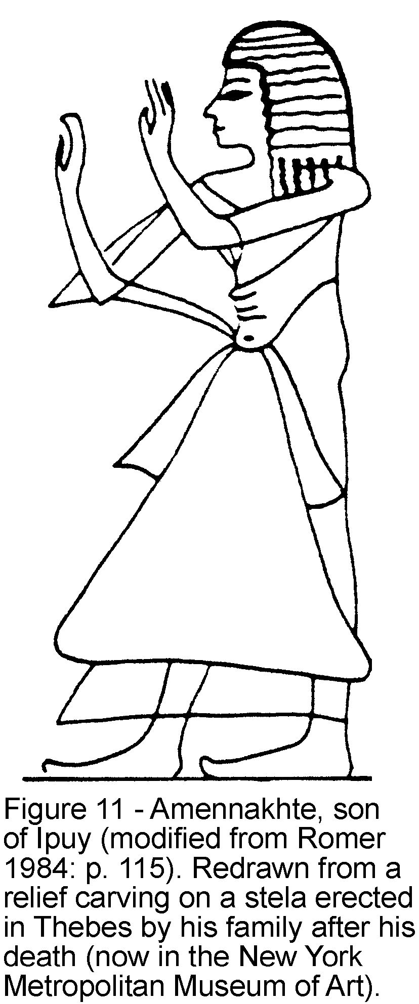
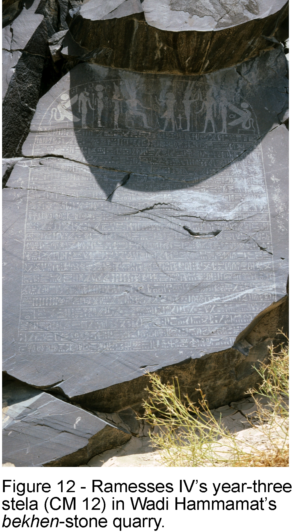
The map was made about 1150 BC by the well-known ‘Scribe of the Tomb‘ Amennakhte, son of Ipuy (Figure 11). It was prepared for one of the quarrying expeditions sent to Wadi Hammamat by king Ramesses IV (1156-1150 BC) of the New Kingdom’s 20th Dynasty. The purpose of these expeditions was to obtain blocks of bekhen-stone that would be carved into statues of the gods, king and other notables. A now famous rock-cut inscription or stela (officially designated CM 12) was left on the quarry wall by this king to commemorate his final and largest expedition during the third year of his six-year reign (Figure 12). According to the inscription, this included 8,362 men, which makes it the largest recorded quarrying expedition to Wadi Hammamat after one about 800 years earlier during the Middle Kingdom’s 12th Dynasty. It is almost certainly for Ramesses IV’s big expedition that the map was made, but what purpose it served is unclear. It could not have been a road map showing the way to the quarry because it only covers a small area with the 75 km between Wadi Hammamat and the Nile Valley excluded. Most likely, it was drawn as a visual record of the expedition to be viewed by either Ramesses IV or Ramessenakhte, the High Priest of Amun in Thebes, who organized the expedition for the king.
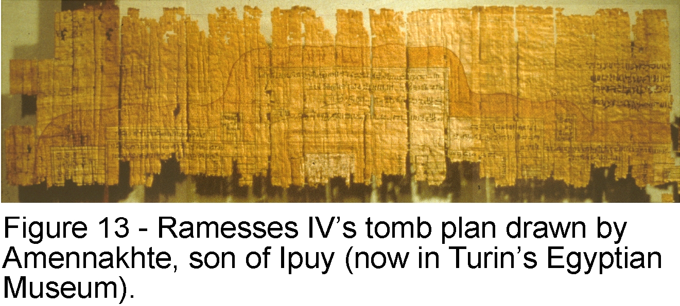
Although Amennakhte did not sign his name to the map, it is clear that he is its author. There are two pieces of evidence that support this identification. First, the text on the map side is in Amennakhte’s distinctive handwriting, which is well known to Egyptologists who have studied his many other writings. And second, the first and earliest text on the backside of the papyrus (the first one listed in Table 3) was written and signed by Amennakhte. It is not at all surprising that Amennakhte would have made the map. As one of the two ‘Scribes of the Tomb’ during Ramesses IV’s reign (along with Hori, son of Khons, who also wrote some of the later texts on the back), Amennakhte was an important administrative official in the Theban region and this is where the map (text 18) says the blocks of bekhen-stone were taken. He is well known from his many other surviving works to be an individual with an unusual combination of scribal, cartographic and artistic skills as well as a ‘sense of geology’. These attributes are especially well displayed on another of his papyri in Turin’s Egyptian Museum. This is an architectural plan of Ramesses IV’s tomb in the Valley of Kings (Figure 13). It is by far the most elaborate and sophisticated tomb plan to survive from ancient Egypt. It has Amennakhte’s distinctive handwriting labeling the parts of the tomb and giving their dimensions, and on the back is his last will and testament. The plan also includes elements of geology, such as a drawing of the king’s sarcophagus in the central burial chamber painted to resemble the pink granite of Aswan from which it was carved, and the location of the tomb under a mountain of well-layered, inclined strata, which is an accurate depiction of the situation in the Valley of Kings.
It is now known that Drovetti obtained both the
quarry map and tomb plan, along with many other papyri, from Amennakhte’s
family tomb at Deir el-Medina. If the map was made for Ramesses IV’s big
quarrying expedition then why did Amennakhte keep it, and why did he and others
reuse its backside for documents and drawings unrelated to the map? The answer
to the first question is unknown, but that to the second is clear. Because
papyrus paper was an expensive commodity in ancient Egypt, it was common
practice among scribes to use the originally blank backsides once whatever was
written or drawn on the front side was no longer needed. In other words, the
papyrus map became scrap paper after the quarrying expedition it recorded lost
its importance, perhaps following Ramesses IV’s death a few years after the map
was made.
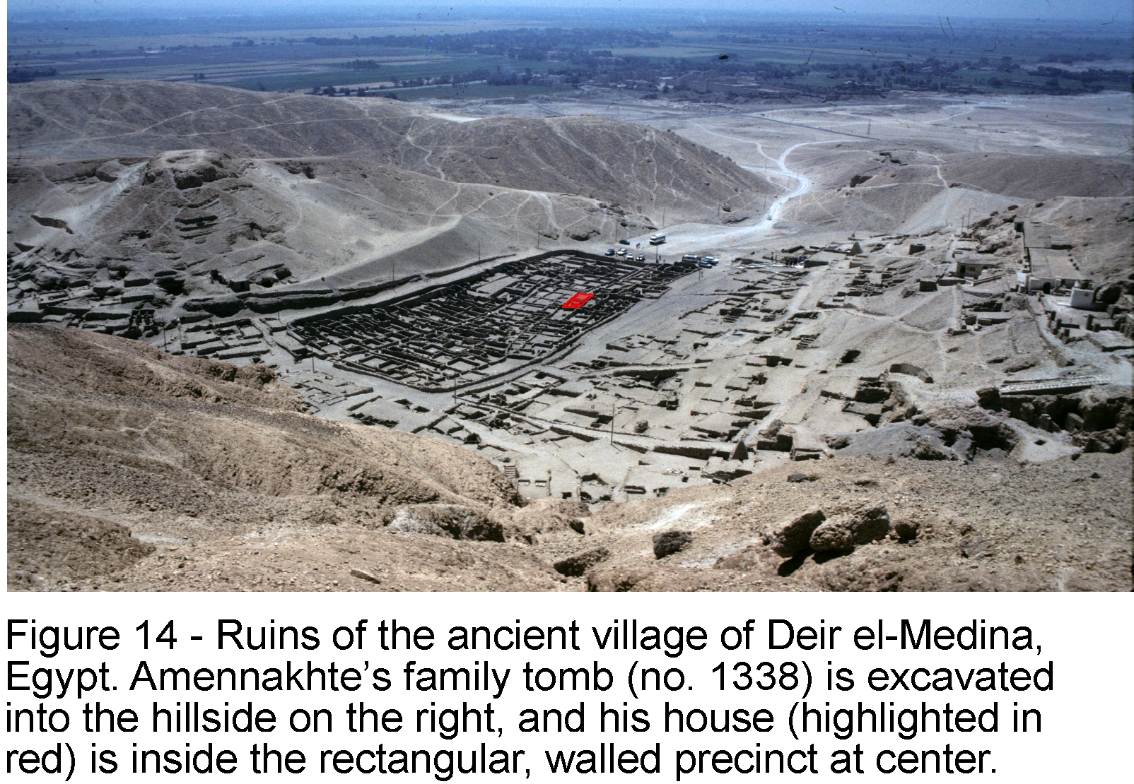
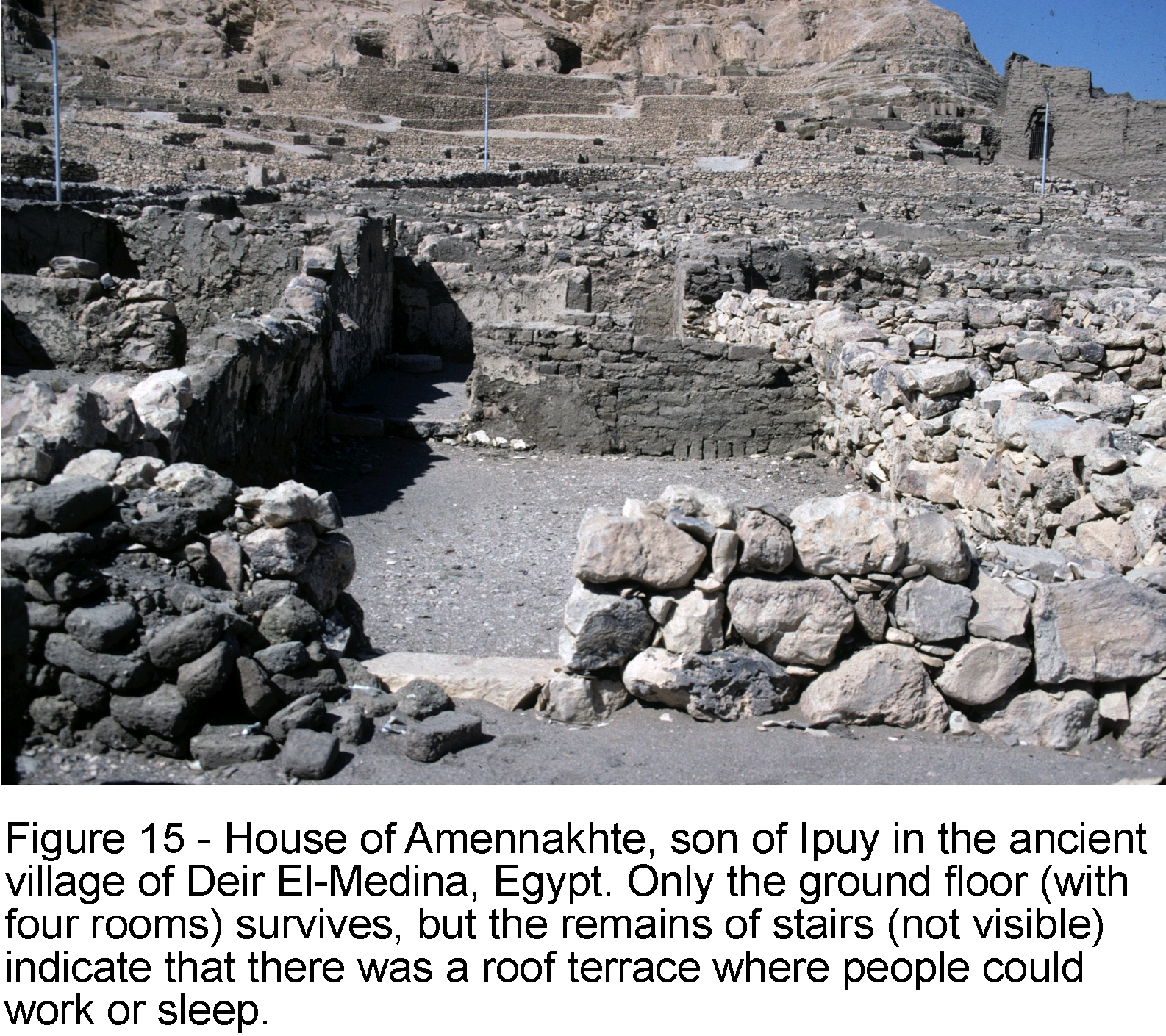
Amennakhte’s family tomb still exists as does,
remarkably, his house in Deir el-Medina (Figure 14
and Figure 15). That it is his house
is known from an inscribed door jamb, now removed for safe keeping, that graced
its entrance. It is interesting to contemplate that it may be in this very
place where one of the world’s oldest and most important maps was made over
3100 years ago.
BIBLIOGRAPHY
Baines, J. and J. Malek. Cultural Atlas of Ancient
Egypt (revised edition). New York: Checkmark Books, 2000.
Bierbrier, M. L. The Tomb-Builders of the Pharaohs.
London: British Museum Publications, 1982. [republished by American University
in Cairo Press, Cairo, 1989]
Carter, H. and A. H. Gardiner. “The tomb of Ramesses
IV and the Turin plan of a royal tomb.” Journal of Egyptian Archaeology
4 (1917): 130-158.
Černy, J. A Community of Workmen at Thebes in
the Ramesside Period. Cairo: Institut Francais d’Archéologie Oriental,
1973.
Harrell, J. A. and V. M. Brown. “The oldest surviving
topographical map from ancient Egypt (Turin Papyri 1879, 1899 and 1969).” Journal
of the American Research Center in Egypt 29 (1992): 81-105.
Janssen, J. J. “An exceptional event at Deir
El-Medina (P. Turin 1879, verso II).” Journal of the American Research
Center in Egypt 31 (1994): 91-97.
Millard,
A. R. “Cartography in the ancient Near East.” The History of Cartography.
Volume 1: Cartography in Prehistoric, Ancient, and Medieval Europe and the
Mediterranean. Ed. J. B. Harley and D. Woodward. Chicago: University of
Chicago Press, 1987. 107-116.
Shore,
A. F. “Egyptian cartography.” The History of Cartography. Volume 1:
Cartography in Prehistoric, Ancient, and Medieval Europe and the Mediterranean.
Ed. J. B. Harley and D. Woodward. Chicago: University of Chicago Press, 1987,
117-129.